

GREENE COUNTY HISTORIAN’S BLOG
The Wreck of the Swallow
The story of a calamitous shipwreck on the night of April 7, 1845 in Athens, New York.
On the snowy evening of April 7, 1845 the steamboat SWALLOW departed her dock at Albany loaded with approximately 250 passengers bound overnight for the City of New York. Fashionable and fast, the SWALLOW offered businesspeople and time-conscious travelers one of the fastest and most comfortable conveyances between the capital of New York State and its unofficial business capital at New York City. The evening route was intended to leave passengers rested and ready the next morning to conduct business at their respective destinations. None knew the journey would end a short two hours later in a cataclysm of shattered timbers, fire, and water — a tragedy summoned by a culture of heedless profiteering endemic to the operation of the steamboats of that age.
The SWALLOW was owned jointly by “The People’s Line of Steamboats on the North River” and “The Troy and New York Steamboat Association.” Daily operations were orchestrated by the Association, a profit-minded assembly of investors including approximately one hundred shareholders with a board of five trustees and three directors. Naturally, much of the decision making behind the operation of the SWALLOW emphasized publicity and revenue over passenger safety.
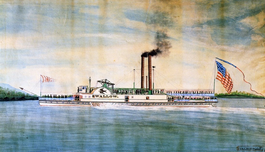
The Steamboat SWALLOW as she appeared around the time of her commissioning as a day boat in 1836. Painting by celebrated maritime artists James Bard (1815-1897) and John Bard (1815-1856), Public domain, via Wikimedia Commons: https://commons.wikimedia.org/wiki/File:Swallow_(steamboat_1836)_by_Bard_Bros.jpg
The speed of the SWALLOW, like many of her contemporaries, was an important selling point and a subject of pride among her stakeholders and management. Following a refit at the end of the 1844 season it was held that the SWALLOW could make upwards of seventeen miles per hour as her top speed — quite fast for that time. This was known because she and competitor steamboats frequently undertook unofficial races which jeopardized the safety of boatloads of paying customers in the name of attracting more passengers to a winning boat on a subsequent trip. By the mid-1840s such races were technically illegal, but no system existed to identify and address those who continued the practice.
While winning steamboats certainly made the headlines in regional papers with regularity, so too did news of the alarmingly frequent disasters that befell boats which were pushed too hard. Boiler explosions, fires, groundings, and collisions appeared in the news just as often as headlines concerning triumphs and broken speed records. The potential for disaster was compounded by flaws in the way steamboat officers were selected. As one example of this systemic problem the pilot of the SWALLOW, William Burnett, was previously “addicted to the use of ardent spirits” though he claimed to have had only one beer while on board the vessel that fateful night. This same pilot had run the SWALLOW aground twice in the past and once sank a sloop in a collision. All of this culminated in his previous dismissal from the post for negligence. His subsequent reappointment prior to the disaster illustrates just how flawed the corporate culture was that would place a man in a role they were demonstrably ill suited for.
In the same Senate report that describes pilot Burnett’s previous struggles with alcoholism and sloops appears a scathing indictment of the entire command structure common among Hudson River Steamboats at that time. The Captain, contrary to every obvious principle concerning the management of a ship, did not have clear authority over the Pilot and Engineer, effectively rendering him a figurehead with more responsibility over the management of passengers than the actual navigation and operation of the vessel. Indeed the tradition of Ships Pursers being elevated to the position of Captain among Hudson River Steamboats endured long after the SWALLOW met its end. With no single experienced person clearly in command there was no possibility of sound judgement ruling difficult or dangerous situations. Then again, it shouldn’t have been a grand question as to whether running at speed was a prudent idea on a dark snowy night.
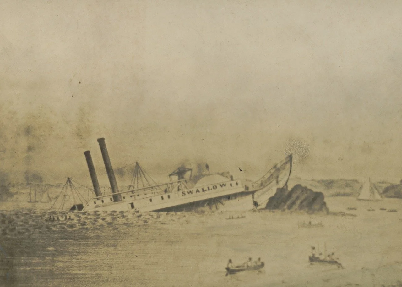
This fatally flawed command structure, paired with a desire among stakeholders and crew alike for speed, had already doomed the SWALLOW as she rushed southward through the night. The SWALLOW rapidly outpaced the ROCHESTER and EXPRESS, fellow night boats which had left Albany at the same time, and likely made an average of fourteen miles per hour the entirety of the distance between Albany and a rocky outcropping called Dooper’s Island along the shoreline at Athens, New York. Around eight in the evening residents of Athens and Hudson alike were woken by a crash heard at least a mile in all directions. Within moments those near the banks of the River in Athens observed the glow of flames that briefly illuminated the silhouette of a steamship, its bow driven over thirty feet into the air upon a rock and quickly sinking by the stern. Passengers poured out onto the decks, many chancing the water to make distance from the wreck lest it continue to burn. The stern sank within five minutes, extinguishing the boilers and nascent fire and plunging all into darkness.
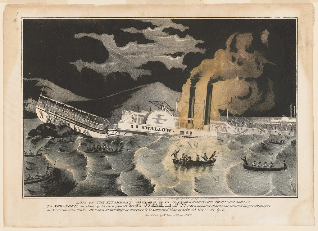
Loss of the steamboat Swallow while on her trip from Albany to New-York, 1845. New York: Published by N. Currier. https://www.loc.gov/item/2002709958/.
Confusion dominated in all quarters from the moment the SWALLOW ran aground and sank. In the common custom of the time no clear accounting of the total number of passengers was ever taken, so it remained (and still remains) uncertain what the exact death toll was. Newspapers throughout the valley began publishing accounts within a day of the sinking, and it was claimed by some that upwards of forty persons died, though only thirteen bodies and one missing child could be identified by the end of the month. The hour of the sinking, the subsequent destruction of the aft staterooms by river currents, and the removal of survivors by the ROCHESTER and EXPRESS as well as good samaritans in Athens meant it was unclear for a time exactly who survived and where they ended up.
Conflicting stories as to the circumstances that precipitated the disaster filled newspapers in the ensuing weeks. These ranged from inclement weather, to racing on the part of the steamboats running that night, and even simple base negligence by the pilot and captain. A select committee charged with investigating the disaster on behalf of the New York State Senate began collecting salient facts within days of the sinking, including detailed measurements of the situation of the wreck and its relationship with the shoreline.
Pilot William Burnett gave testimony certain to cast himself in a prudent light, stating that after coming past Four Mile Point he slowed the SWALLOW to approximately seven miles per hour and proceeded with caution. This testimony conflicted with his additional assertions that he had fine visibility and knew his position relative to the Athens shoreline moments before the collision. Ultimately he blamed a strong crosswind for blowing the SWALLOW off course within about six hundred feet of the rock. The written reply of the select committee, after introducing the pilot’s narrative, read thus:
“The committee cannot reconcile this story with the facts.”
The select committee chalked up Burnett’s testimony as predominantly nonsense, and rightly so. The SWALLOW covered the roughly 27 miles from Albany in two hours. Simple arithmetic gives us an average of almost fourteen miles per hour being necessary to accomplish that. Accounting for the points in the journey when the pilot gave an account of his speed as being half that or less (including the departure from Albany and his oddly prudent pass through the Athens channel) this means the SWALLOW would have had to exceed its top speed elsewhere at other dangerous points in the channel coming south from Albany.
That Burnett’s testimony was riddled with falsehoods is corroborated by several facts uncovered by the select committee. The absurd position of the wreck, which couldn’t have arrived so high upon the rock unless it had been moving at a tremendous rate, illustrated clearly the speed and force of the impact. Some passengers submitted a subsequent resolution defending the pilot’s testimony, but others found fault in it and the question remains whether passengers enjoying the evening in comfortable aft staterooms could have had a clear sense of the Ship’s speed in the dark.
Likewise, the committee found it irregular that any pilot would have decided to slow their vessel at a position where the channel became so clear and defined. It was in fact highly unusual among pilots to slow their speed at Athens and the report elaborates on this point at length. Indeed, even Burnett said he could see his location well despite the weather. Lastly, none except the pilot claimed to have observed any wind that could have acted with such force to cast the SWALLOW off course in such a short distance.

Detail of a map prepared by the select committee showing the position of the wreck in mid-April of 1845.
The SWALLOW came to rest upon the rock more or less at coordinates 42.263750, -73.804724. This location is now part of the shoreline at Athens situated immediately north of the the Village’s sewage treatment plant. Where it had once been known by several names depending on the source, the sinking thereafter earned the island the moniker “Swallow Rock.” The rock endured at least into the 1870s, at which point encroaching fill for an ice house finally covered it up, but local writers were able to refer to the location with certainty into the 20th century.
This is not to say that the sinking of the SWALLOW didn’t endure in collective memory. Generations of Athenians were regaled by tales of the disaster, and debate as to the causes of the wreck have captured the imaginations of countless writers and historians. In a way this was the only lasting result of the tragedy. The wreck of the SWALLOW was removed and hauled away about a month after the sinking - its timbers famously salvaged for a house in Valatie, the running gear repurposed, and its dead buried. William Burnett was put on trial for manslaughter but acquitted, and the night boats kept running as before.
The select committee’s report was submitted to the senate at the end of April while salvage operations were underway at Athens. It conveyed the nascent awareness of a nation becoming increasingly sensitive to the mounting evidence of an industry running roughshod over the best interests of the traveling public. There was undoubtedly some appeal in a slow boat where passengers survived over a fast one which perpetrated the occasional massacre, and it didn’t take men of vision to see that regulation must reign where decency would not.
In calling for new safety regulations, the committee members included in their conclusions a passage from Emer de Vattel’s The Law of Nations: “If a nation is obliged to preserve itself, it is no less obliged carefully to preserve all its members.” It would take almost a decade and two more horrifying accidents on board the HENRY CLAY and the REINDEER (standouts in a slew of more minor incidents) to bring about the regulation necessary to improve the safety of steam transportation on the Hudson River.
By Jonathan Palmer, Greene County Historian. Questions and comments can be directed to Jon via archivist@gchistory.org
Additional Reading:
Senate Document no. 102 submitted by the Select Committee appointed to investigate the cause and circumstances of the late disaster of the steamboat Swallow, on the Hudson River, April 26, 1845.
Captain William Benson’s relation of the tale of the disaster, courtesy of the Hudson River Maritime Museum.
Andrew Amelinckx’ version of the tale as published on Hudson River Zeitgeist.
The Irish Colleens of Saint Joseph’s Chapel
Debunking the myth of the Irish Colleens of Saint Joseph’s Chapel in Ashland, New York.
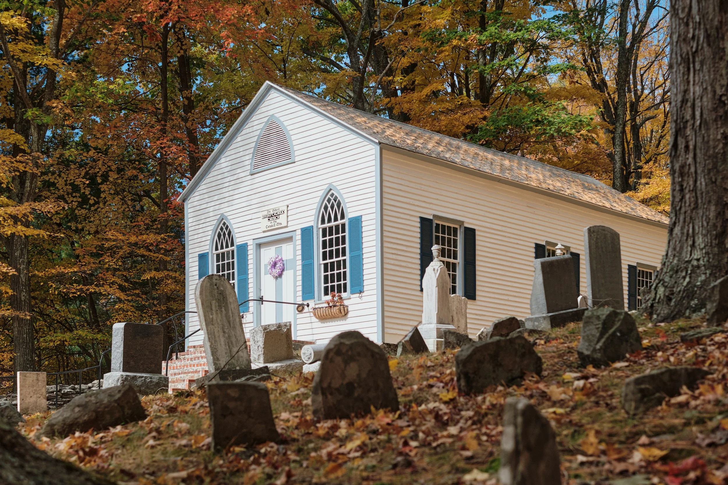
Near the Ashland/Prattsville Town Line overlooking the valley of the Batavia Kill stands a small chapel and churchyard on a rise above State Route 23. Passersby generally pay no heed to it as they travel past at sixty miles an hour, but for those who catch the sign “Oldest Catholic Church in the Catskills” and take time to stop the rewards are manifold. Saint Joseph’s chapel claims to have been built around 1800 during the earliest years of the settlement of Old Windham, and one might believe it to see the full churchyard with gravestones edging right up to the building’s walls. One stone in particular stands out — a granite shamrock upon which is carved the following:
Irish Colleens
In loving memory of the 14 Irish girls who came from Ireland in the 1800s
and who tragically lost their lives in a fire. They are buried here in a mass grave.
May God bless them and hold them in the palm of his hand.
The passage is repeated in Irish directly below. The humbling spectacle of the oldest Catholic Church in the Catskills paired with this marker near its entrance would create a particularly poetic and stirring composition were it not for some inconvenient details… Saint Joseph’s is not the oldest Catholic church in the Catskills, and the tragedy of the fourteen Irish Colleens never happened.
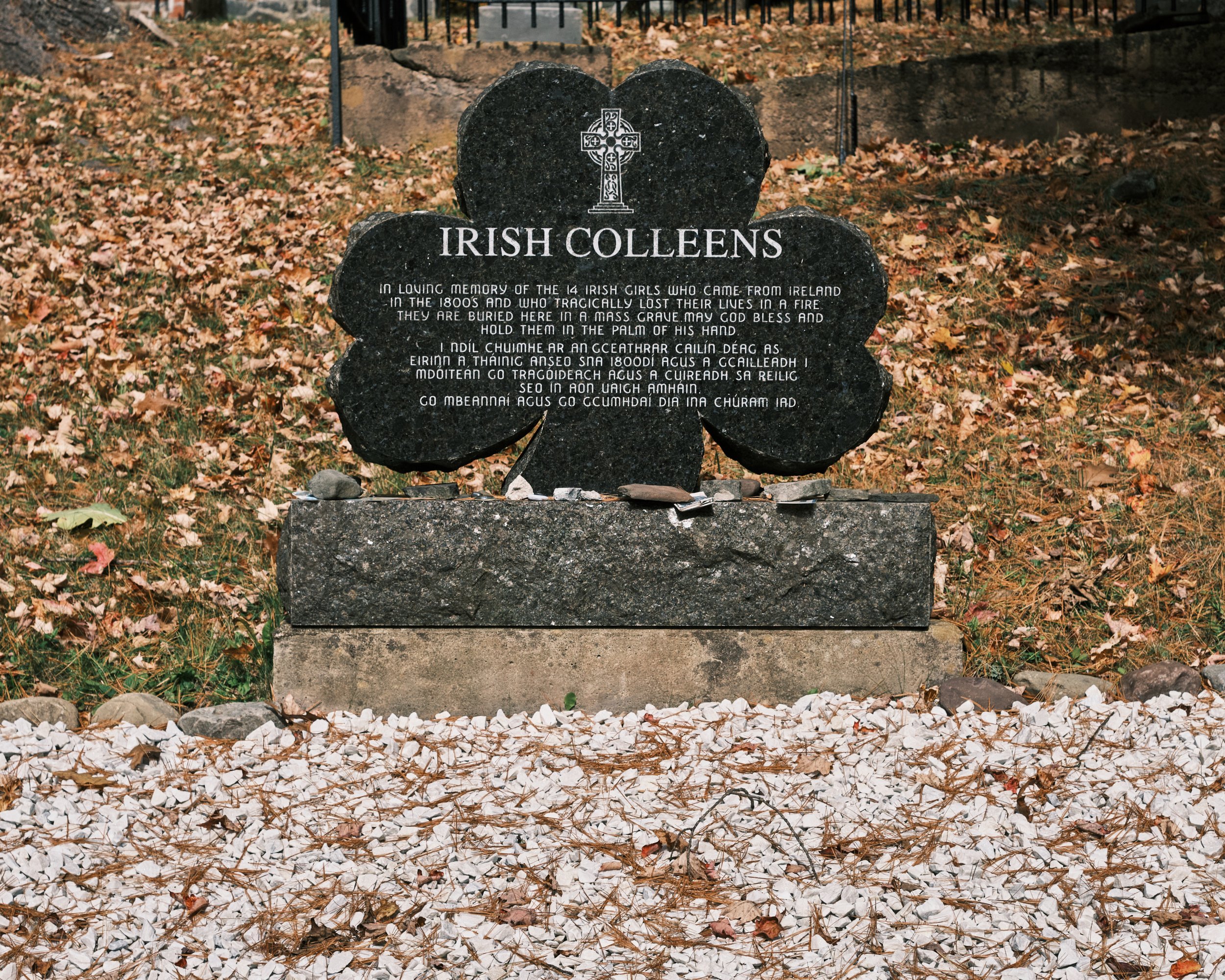
The granite monument to the fourteen Irish Colleens which stands near the entrance to Saint Joseph’s chapel and cemetery in Ashland, New York. Palmer Photo.
The marker to the Irish Colleens of Ashland is responsible for fomenting at least one or two inquiries annually by phone and email to the Greene County Historical Society. The story also invariably gets recycled now and again on social media. Countless people have offered speculation and possible avenues of research to uncover more details about this tragic yet vaguely contextualized disaster, but none have borne fruit and no local historian has ever found a lead. Thus, in order to finally put this myth to bed we must first consider the facts surrounding the industrialization of the Northern Catskills, the development of the Irish immigrant community in Prattsville and Ashland, and the origins of Saint Joseph’s Chapel itself.
The story of the arrival of formal Catholic services in Greene County is tied hand in hand with the creation of the great tanneries of Hunter and Prattsville in the second and third decades of the nineteenth century. William Edwards’ New York Tannery at Hunter village is widely considered to be the great pioneer of that industry and was put in operation in 1817 with backing from investors in New York City. The New York Tannery and others like it created a considerable demand for labor in the tanneries themselves and in adjacent trades. With every tannery that opened so followed a legion of tanners, carpenters, blacksmiths, drovers, bark-peelers, mechanics and the like — all added to the growing tally of skilled and unskilled labor rapidly filling the Northern Catskills.
At Hunter as early as 1830 it is claimed there was a large enough immigrant Irish Catholic contingent among the laborers there to merit the occasional visit of a Priest from Albany, which was then part of the New York Diocese. By 1839 those congregants were so numerous that a subscription was raised to secure funds for the construction of a church. This culminated in the completion of Saint Mary of the Mountain as the first Catholic Church in Greene County with Rev. Bernard O’Farrell as pastor the following Spring. Two years later in 1842, following the appointment of Rev. Michael Gilbride as the second pastor at Saint Mary’s, work was begun to create a mission chapel to service the growing Catholic contingent at Red Falls — a small hamlet east of Prattsville village along the Batavia Kill.
The Metropolitan Catholic Almanac first lists a church at Scienceville (the old name for Ashland) on the directory of Catholic houses of worship in the New York Diocese in 1843. The church at Hunter had been listed previously beginning in 1840, making Saint Mary of the Mountain the oldest Catholic Church in Greene County and Saint Joseph’s Chapel a close second. With the demolition of Saint Mary’s in 2017 the chapel at Ashland can now safely claim oldest surviving Catholic church in the County, though by no stretch of the imagination could it ever be dated to “circa 1800” — eight years before the Diocese of New York was even formed.
The need for a church at Red Falls was precipitated by the same type of development that had fomented the rise of an Irish Catholic community at Hunter. The vast tannery of Zadock Pratt at Prattsville (established in 1825) and one run by Foster Morss and his son Burton (established in 1830) at Red Falls were catalysts for the development of those communities, but they soon became just one part of the rapidly evolving industrial landscape in that section of the mountains during the Antebellum period. By 1850 Prattsville and the newly formed town of Ashland sported a cotton mill and two hat factories in addition to a number of lumber and grist mills, a developing cottage dairy industry, and the old established forest industries.
It should be said before we continue that the most important piece of evidence that the Irish Colleens tragedy never occurred is the fact that it was never recorded, reported, or recollected by anyone in the time since the event could have transpired. Fourteen women dying in a fire would be the second greatest disaster behind the Twilight Inn fire to have ever occurred in the County’s history, not to mention being the greatest industrial disaster to ever occur here. Such things do not get omitted from collective memory, nor were such stories overlooked by newspapers.
Disasters such as the one alluded to by the Irish Colleens monument were the catnip of newspaper editors in the 19th century. Editors reported every disaster to befall their respective communities - be it housewives catching fire while tending the stove, children drowning, uninsured warehouses burning down, or people dying of hydrophobia - and if such disasters weren’t befalling their readership then editors simply copied disaster news from other papers around the country. The reason for this was of course because at the end of the day disasters sold papers. People would have gobbled up the tale of fourteen immolated Irish women in the Catskills. No such disaster can be located in any newspaper database, and no mill or tannery in that area ever burned with the loss of any woman’s life.
It is important in supplement to this glaring lack of evidence to establish whether a scenario ever could have existed in which fourteen Irish immigrant women could have been killed in a fire - be it in a mill, boarding house, or otherwise. This analysis begins with the 1850 United States Census, being the census immediately following the height of the Potato Famine (when the Irish immigrant population should have been proportionately high) and subsequent to the 1848 opening of Burton Morss’ cotton mill at Red Falls. The 1850 Census is also the first in which every member of a household is listed with their place of birth.
What that census illustrates broadly is the following: a little over 6% of the population of Prattsville claimed to be Irish immigrants (≈125 persons out of 1,989 people), while a little over 2% of Ashland’s population (≈29 of 1,290 people) listed Ireland as their place of birth. Of those people, the Irish immigrants were predominantly members of family groups in which one or both of the parents were immigrants whose children were mostly or exclusively born in the United States. Irish immigrants not living in a family setting were predominantly unattached men working in industry or household servants and boarders generally numbering no more than one or two persons in the homes of established local families. One home in Ashland contained six immigrant Irish men with no clear trade specified living with Solomon Christian, a local farmer with a young family.

The entry from page 18 of the enumeration of Ashland, Greene County, from the 1850 United States Census showing Solomon Christian, his young family, and a slew of boarders who were predominantly male Irish immigrants.
The 1855 New York State census illustrates some interesting changes. Roughly 5.2% of Prattsville’s population reported their birthplace as Ireland (≈84 of 1588), while just under 2% of Ashland does the same (≈20 of 1094). This decrease, particularly in the Town of Prattsville, may have been due to the closure of some local tanneries and the transformation of the economic landscape of the town. Broadly the same fact remains constant however that most Irish immigrants lived within family units or were otherwise unattached males living as boarders. Several more unattached young women or daughters of families living elsewhere in town are listed working as servants with established local families.
The 1855 census interestingly also lists a Roman Catholic church at Ashland with an attendance of about 150 congregants — this number is roughly equivalent to the total number of Irish-American families living between Prattsville and Ashland who could have been potential congregants. This assumes for example that the fifty or so children appearing in households where at least one parent was an Irish immigrant in Prattsville would make up a portion of those attending while also not accounting for those practicing Catholicism who were not Irish-American.
The next census examined was the 1865 New York State Census following the Civil War. In this census surprisingly only 2% of the population of Prattsville reported their birthplace as Ireland, and in Ashland eight people stated they were Irish immigrants. These decreases correspond with a continuing decrease in the total populations of each town. Notably the Roman Catholic church is not listed as an active congregation at this time, though it reappears in later censuses. As with previous years those born in Ireland are almost exclusively part of family groups or servants in households of established local families.
The 1870 United States Census, 1875 New York Census, and 1880 United States Census all continue to illustrate this trend of general decline in percentages of the population of Prattsville and Ashland who reported their birthplace as Ireland. By 1880 nobody reports their birthplace as Ireland in either town. Though this may reflect minor reporting or recording biases it nonetheless illustrates how rapidly the initial Irish-American community associated with Saint Joseph’s appears and then disappears.
Cumulatively, these censuses illustrate that it would have been highly irregular in the years following the organization of Saint Joseph’s Chapel for fourteen immigrant Irish women to have found themselves in a scenario where they all could have died in a fire. While an event at a workplace would certainly be most likely, any fire that could have occurred would have killed more people than exclusively Irish immigrants. Take for example Burton Morss’ cotton mill, which was the largest employer at Red Falls, with a claimed figure of forty women and thirty men employed while it operated between 1848 and 1881. It is evident from the 1850, 1855, and 1865 censuses that the mill employed both men and women, and that many people from established local families worked alongside those who had been born elsewhere. Likewise, boarding houses in the area seemed to have catered to both men and women and boarders didn’t hail exclusively from one region or place of birth.
❈ ❈ ❈
While this is all quite interesting it should come as no surprise that all evidence stands in contrast to the tale related on the Irish Colleens monument. In fact the only surprise here seems to be the monument itself, which so far as can be discerned appeared along the staircase to the chapel sometime in the 1990s. An inquiry submitted by a researcher to the Greene County Historical Society in 2009 notes the appearance of the marker “about ten or fifteen years ago” and relates his desire to confirm the circumstances it commemorates. The marker pairs odd specifics (fourteen women) with useless dates (“the 1800s”) and omits where the disaster happened, only that there was a fire. Frankly the monument reads more like the end result of a children’s game of telephone… and that analogy may not be far from the truth of its origins.
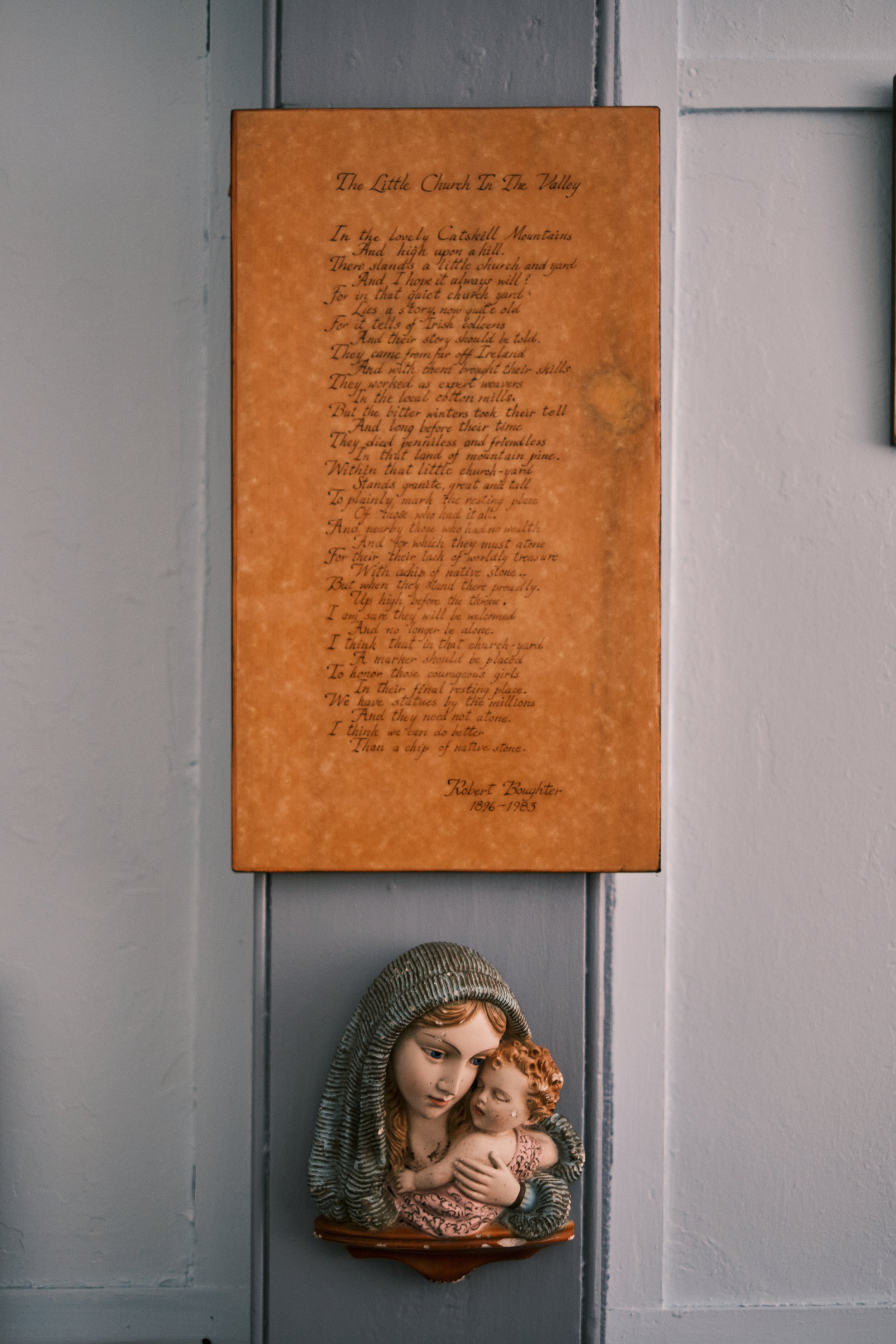
Robert Boughter’s poem “The Little Church in the Valley” displayed within Saint Joseph’s Chapel.
At some point probably in the 1950s or 1960s a poem was written by Robert Boughter of Windham lamenting the “haves and have nots” tale of the Irish immigrants who came to work in the mountains in the nineteenth century. His poem to the memory of the Irish Colleens, while not exemplary of the form, is a poignant and earnest tribute to the story Boughter understood to be the truth about the people who came to work in Red Falls at Burton Morss’ cotton mill. He paints a vision of the classic New England textile mill wherein floor upon floor of immigrant women and girls from the countryside toiled away in despair on behalf of fat cat bosses.
In Boughter’s poem those women die in anonymity after having lived a life of anonymity, being buried as he puts it “beneath chips of native stone” while nearby “stands granite great and tall to plainly mark the resting place of those who had it all.” He closes with an admonition to the reader that a marker should also be placed to commemorate those women, not alluding however to any disaster or mass grave. Boughter simply laments the tragedy of the scores of uninscribed fieldstones marking their burials, assuming without evidence that many represented the unattached “Irish Colleens” with neither family nor means to adorn their own graves. The mountains are loaded with cemeteries containing scores of unmarked headstones made from native fieldstone slabs, and it will take considerable further study to determine if this phenomenon is socioeconomic, an expression of piety, or some mixture of the two. Either way it was not a phenomenon unique to Saint Joseph’s or the Irish Catholic community in Red Falls.
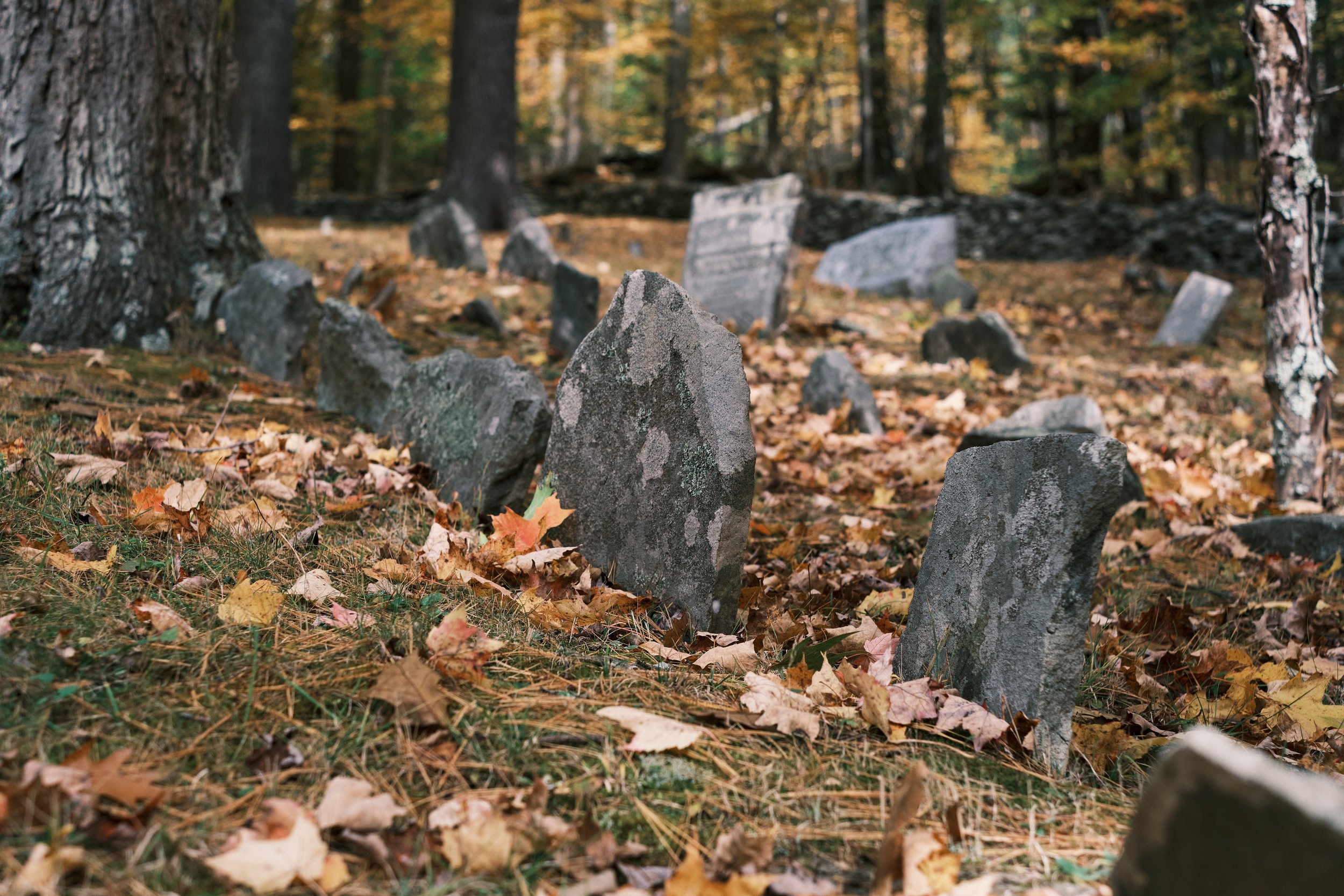
Some of Robert Boughter’s aptly styled “chips of native stone” in the Catholic cemetery at Saint Joseph’s Chapel.
Boughter is of course imposing his own expectations on what the nature of the working community at Red Falls was during the mid-19th century and assuming that primarily imported labor comprised Burton Morss’ workforce. As said previously the censuses of 1850, 1855, and 1865 plainly illustrate this was not the case. Were Boughter’s vision of the past correct, this would have required nearly fifty percent of the Irish immigrant community in Ashland and Prattsville at its peak circa 1850 (roughly 150 people total) to be employed just at Morss’ mill, never mind all the other places those people listed as their actual occupations. Moreover, the cotton mill operated until 1881, well after the population reporting their birthplace as Ireland in both towns had dwindled to virtually zero. This all aside, it is important to remind everyone again that none of the mills there ever burned with catastrophic loss of life.
When Boughter died in 1983 he was laid to rest in the back of the cemetery at Saint Joseph’s among the “chips of native stone” he fancied as being the markers of the Irish Colleens. On his grave he had inscribed “The Irish Colleens” followed by his own epitaph “In Memory of Robert Boughter, 1896-1983.” In this way his own grave finally fulfilled the need he perceived for a marker to honor the women central to the story he contrived of the mill at Red Falls. This makes the subsequent appearance of the Irish Colleens monument not only somewhat redundant, but also illustrative of a progression in the evolution of an already somewhat imaginative vision of the past. Thus the Irish Colleens monument stands today an expression of misconstrued recollection rather than a long-overdue tribute to an actual tragedy.
History of course is merely our conversation with the available facts of the past. The discovery of new details can move that conversation in many directions, but the conversation only bears fruit if we act in concert with the evidence at hand. Perhaps it is time — out of respect to the legitimate story of the Irish Catholic community that once called this corner of the Catskills home — to finally put this legend to rest.
By Jonathan Palmer, Greene County Historian. Email Jon at archivist@gchistory.org
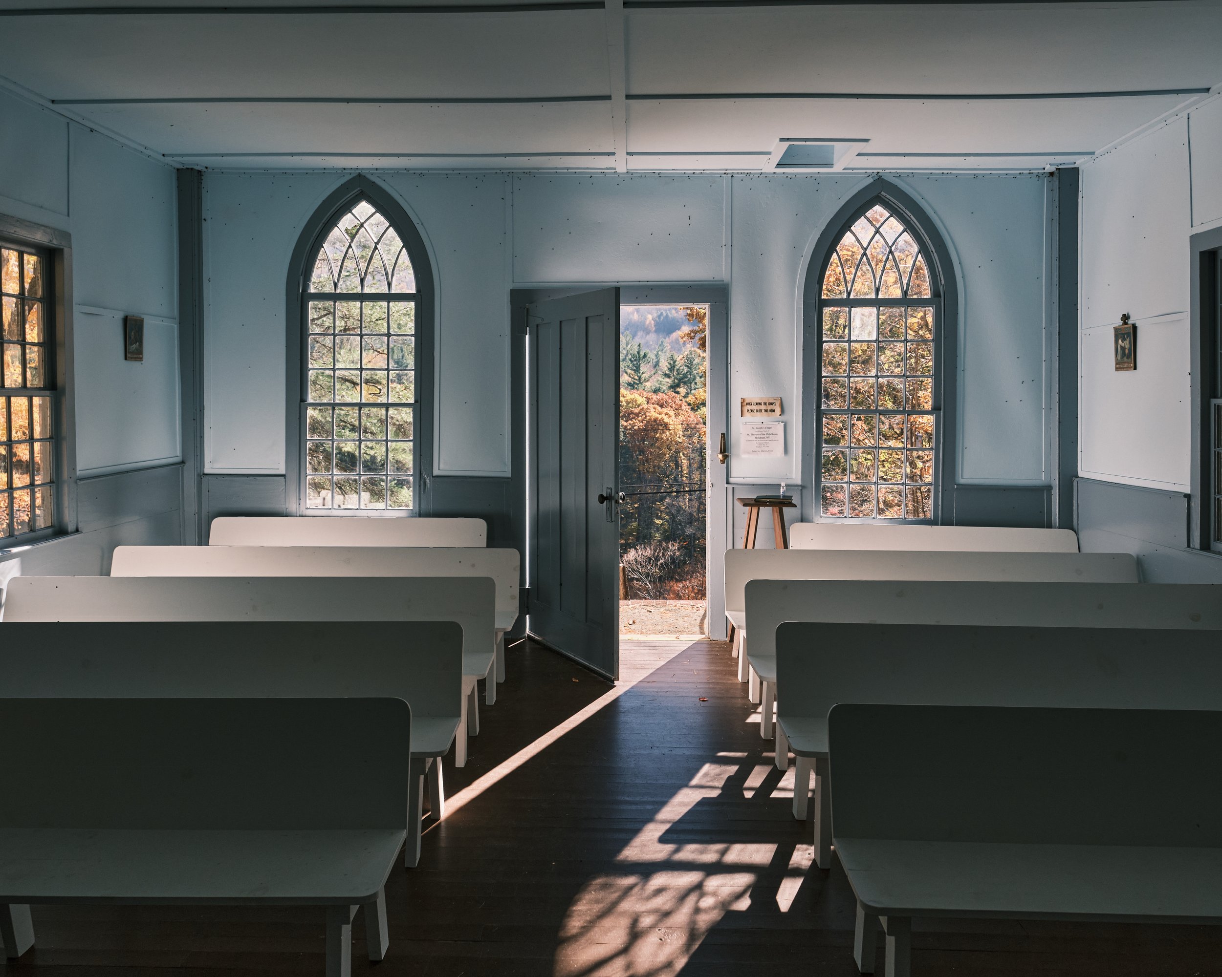
The interior of Saint Joseph’s Chapel, Ashland, New York. Palmer Photo.

On The Frontier
A map sheds new light on the life of Johannes Strope, a settler who was massacred in Round Top, Cairo, NY in 1780.
This article originally appeared online under the title “William Cockburn’s Map of the McLean, Treat, and McLean Patent.”
In a recent two-part article for Porcupine Soup, Sylvia Hasenkopf shed light on the grim story of the 1780 Strope Massacre in the hamlet of Round Top in the Town of Cairo. The circumstances of this raid by warring Indians and the killing of Johannes Strope and his wife were recorded by regional author and pamphleteer Josiah Priest and sampled heavily by Charles Rockwell in his book The Catskill Mountains and the Region Around. Beyond the circumstances of the massacre narrative little today endures to relate the substance and nature of Johannes Strope and his family’s life on what was then one of the frontiers of European settlement. A recently cataloged map helps dispel a bit of this obscurity.
William Cockburn was a native of Scotland with an artist’s eye and a knack for numbers. He probably emigrated to the Province of New York sometime in the early 1760s, and by the end of that decade was engaged virtually full-time surveying and delineating the vast collage of (often inconveniently overlapping) land patents which for almost a century had slowly crept their way westward from the Hudson to the interiors of the Catskill Mountains and beyond. Season after season, patent after patent, William Cockburn and his kid brother James surveyed and prepared maps which in themselves were objects of beauty and precision. However, in practical application the lines of their surveys wove a web which first expelled the land’s original inhabitants and subsequently ensnared generations of tenants on behalf of an increasingly land-rich provincial aristocracy.
The work of the Cockburn brothers was the work of colonization - with compass and chain they realized westward expansion rod by rod and blaze by blaze across the lands of countless native tribes in the name of the Province and those who ruled it. Each survey they prepared represented the definitive realization of tracts vaguely described in deeds and letters patent often prepared by proprietors who had never seen nor fully understood the scope of their own lands. The Cockburns were among those charged by the new owners with contextualizing and reporting on those lands in all their detail. In reports and maps William and James Cockburn related where respective lands were, what was on them, what merits existed for improvement, and how such improvement might be accomplished by the Cockburn brothers’ respective clients.
This work as vanguards of a new paradigm in land use and land ownership required infrastructure and support - itemized bills for the joint and individual labors of the Cockburns list everything from the total cost of provisions, payment for individual laborers who assisted the surveys, costs for searches at clerk’s offices, travel time, and the expenses for drafting reports and maps ultimately destined for the desks of the new lords of the Catskills: the Livingstons, Duanes, Van Rensselaers, Clarkes, and their peerage.
Such was the case with a map prepared by William Cockburn from a survey he completed in July of 1768 for Lieutenant Neil McLean, Doctor Malachi Treat, and Doctor Donald McLean, all late of his majesty’s service (probably in the Seven Years’ War). Treat and the McLeans were granted two tracts of land - one a large quadrilateral over the East Kill Valley in modern Jewett, the other an inexplicable shape made to fit against the bounds of the old Catskill Patent in modern Cairo. Cockburn’s map lists many anecdotes concerning the prospects of the land: the variety of timber, the prime farmlands, and the context of the land in relation to the river and “Blue Mountains.” The homes of several settlers are also shown, and the names of “persons employed in the survey” are interestingly related at the lower left of the map.

William Cockburn’s map of the McLean, Treat, and McLean Patent of 1768. Vedder Research Library.
The names of Cockburn’s assistants are as follows: John Pierce, Johannes Strop, [illegible] Young, William Hume, and John Wigram. Also shown on the map, just outside the bounds of the McLean and Treat lands in Cairo, appears the cabin of Johannes Strope on an upper reach of the Shinglekill; the house being more or less in the vicinity which local tradition bears out as the location of the massacre perpetuated twelve years after the map was produced. Whether the Johannes employed by William Cockburn was the ill-fated father or his eldest son is unclear, but it does illustrate the types of paying labor available to someone settled on the frontier in that time. It also places Strope on one side of the contentious conflict surrounding native expulsion caused by continued European encroachment on Native territory. Strope, as a participant not only in the settlement of the frontier but as a laborer in the surveys to perpetuate westward expansion, was engaged in a high-stakes contest long before the Revolution brought turmoil, and ultimately doom, to his family.
By Jonathan Palmer, Greene County Historian
Sources:
Cockburn, William. 1768. Map of Two Tracts of Land Granted to McLean, Treat, and McLean. Vedder Research Library. http://localhost:8081/repositories/2/resources/129
(the map which is the central object of the article.)Letter from William Cockburn to George Clarke, Philip Livingston, & Thomas Jones, 1797-06-15. Box 30, Folder 52, George Hyde Clarke Family Papers, Division of Rare and Manuscript Collections, Carl A. Kroch Library, Cornell University, Ithaca, NY 14853https://nyheritage.contentdm.oclc.org/digital/collection/p16694coll66/id/2204/rec/2
(A letter representative of the advisory role of the surveyor in their relationship with the proprietors who retained their services)Elisha Andrews Affadavit and Statement, 1789. Box 30, Folder 32, George Hyde Clarke Family Papers, Division of Rare and Manuscript Collections, Carl A. Kroch Library, Cornell University, Ithaca, NY 14853 https://nyheritage.contentdm.oclc.org/digital/collection/p16694coll66/id/2086/rec/1
(An interesting document testifying to the tense relationship between the surveyors working on the frontier and native people sensitive to the encroachment perpetuated by their work.)Letter from William Cockburn to Goldsbrow Banyar Jr., 1805-03-12. Box 30, Folder 83, George Hyde Clarke Family Papers, Division of Rare and Manuscript Collections, Carl A. Kroch Library, Cornell University, Ithaca, NY 14853 https://nyheritage.contentdm.oclc.org/digital/collection/p16694coll66/id/2456/rec/1
(Another letter in which William Cockburn is seen to give direct advice on the ultimate division and utilization of land to facilitate its access and improvement.)Finding Aid for the Cockburn Family Papers, 1732-1864. Revised 2017. New York State Library Manuscrtipts and Special Collections. https://www.nysl.nysed.gov/msscfa/sc7004.htm
(Honor Conklin’s finding aid for the Cockburn Family Papers, containing valuable contextual and biographical information on the family.)

John Cantine's Map of Catskill
An examination of two segments of a map of Catskill from 1798 prepared by John Cantine.
This article examines the contents of two segments of a map digitized and made available to the public freely through the New York State Archives. All images are taken from downloaded versions of these maps, which are available to study through the links in this article.
~
John Cantine’s 1798 Map of the Town of Catskill is one of those fascinating documents which we in the history business call an “RRDCM” (meaning Really Really Dang Cool Map). Cantine’s map is one of three maps prepared in the late 1790s showing the southernmost towns of Albany County which were soon to be partitioned into the new County of Greene. The other two maps are linked here, but to follow the descriptions in this article you should jump right to the two links for John Cantine’s map.
Leonard Bronk’s map of the Town of Coxsackie can be viewed through this link: https://digitalcollections.archives.nysed.gov/index.php/Detail/objects/36974
David Baldwin’s map of the Town of Freehold can be viewed through this link: https://digitalcollections.archives.nysed.gov/index.php/Detail/objects/36974
John Cantine’s map of the Town of Catskill can be viewed through these links: https://digitalcollections.archives.nysed.gov/index.php/Detail/objects/36925
https://digitalcollections.archives.nysed.gov/index.php/Detail/objects/36924
Examining the eastern half of the Map of Catskill the first thing observers should note is that along the river at the northern boundary of the Town the small hamlet of Loonenburg labeled as “Esperanza” can be seen with the Zion Lutheran Evangelical Church drawn in as its most prominent building. The lower village which became Athens in 1805 appears just south of Esperanza as a solitary little structure which could quite possibly be the Jan Van Loon House which still stands at the south end of the modern Village (it’s the little yellow cottage by Route 385 so many of us are familiar with). This illustrates an odd bit of trivia: the Village of Athens was incorporated within the bounds of the Town of Catskill a year before the Village of Catskill was incorporated. I assure you that your friends will find this fact very interesting if you relay it to them at social gatherings.
Looking at the southern end of the map one can easily spot the location of the modern Village of Catskill, shown with a rough grid approximately reflecting the street plan of the rapidly growing community at the mouth of the Catskill Creek. Following the many roads leading from the Village going west and south it is interesting to note that John Cantine not only drew the roads from actual surveys (roads with an “x” on their route indicate that these are accurate to their surveys) but that he also included important homes, mills, and taverns at their proper locations. This is remarkable because many buildings now otherwise lost to time appear in their accurate locations. The mill shown on the Hans Vosen Kill is a perfect example of this. It was possibly the earliest mill built in Catskill in the late 17th century, and Cantine shows it just east of Jefferson Heights in 1798 — giving us a more complete idea of its whereabouts on this small tributary, as no physical traces of the site now remain.
Out in modern Leeds it is curious to note how sparsely developed the hamlet looks. Leeds at that time was not yet graced with its two large textile mills and still reflected its earlier agrarian appearance. Following the road west out of the hamlet (marked by Schuneman’s House and Mill) one can trace where it crossed the Catskill Creek at the Leeds Bridge at which point the road turned along the flats heading near to where the Barnwood Restaurant now stands on Route 23. In 1798 the Dutch Reformed Church stood just west of there on Cauterskill Road, and Cantine faithfully rendered the old church at that spot on his map. A NYS Roadside History Marker is all that remains to indicate that this important early Church stood on that spot.
The second half of the map isn’t as jam-packed with interesting sights as the eastern portion, but it is still an equally intriguing window into the cultural landscape of Catskill. Starting at the eastern or right side of the map a few points of interest are immediately apparent. First is the route of the Town’s southern boundary which, after proceeding westerly from the Hudson River at the Embought, reaches a point at the center of the small spit of land which once divided North and South Lake. From that point the line proceeds westerly on a slight adjustment where it ends at a point in the woods west of the Pleasant Valley Cemetery in Ashland, probably somewhere near modern Campbell Road.
This southern boundary intersects several roads, the strangest of which is shown halfway between North-South Lake and Pleasant Valley. The road terminates just north of the boundary line at a small cluster of cabins which Cantine carefully drew in. This small settlement seems like it could probably be somewhere in the East Kill Valley around East Jewett, and the road shown reaching it could be a spur of the old road from Mink Hollow, though the map doesn’t show enough detail to confirm the possibility. Resolving the conjectures I’ve made will take much more study.
In a separate essay titled “On The Mountain Top” I covered an explanation of the westernmost corner of this map where Medad Hunt’s farm and tavern stand was shown in Pleasant Valley. The year after this map was made Medad Hunt donated land nearby to create the first meeting house in old Windham. More extensive write-ups on this history appear in Rev. Henry Hedges Prout’s “Old Times in Windham” series which originally ran in the Windham Journal in the 1870s and was published as a compilation by Hope Farm Press in the 1960s.
No details are shown along the northern boundary moving west to east across the map until it reaches a cluster of roads at its far right edge near the Shingle Kill in modern Cairo. This lack of detail can be explained in part by the boundary intersecting a lengthy stretch of inhospitable terrain along the escarpment of the Catskills. The roads and hamlet shown at the eastern side of the map are actually back down in the valley, though to look at the map one would never know there were any mountains or other geographic features sans the few creeks and streams Cantine added for reference. I’m at a loss why he decided to eliminate such definitive geographic features, but it may be that he decided not to include the mountains because he had no accurate survey of them to base his rendition on.
Down in the valley the hamlet of Kiskatom (later Lawrenceville) is drawn in northeast of North-South Lake and is described as the “Settlement at Kiskatammiska.” This name is one of the many attempts to derive a phonetic spelling of a name applied to what was variously called the Kiskataminiska Patent granted to Henry Beekman and Gilbert Livingston in the 1710s. The original patent covered a stretch of several hundred acres north of Palenville running below the escarpment of the Catskills. This land was divided and leased by the Beekmans and Livingstons prior to the Revolution, so the homes and settlement shown here, unlike the ones on the Mountain Top, were relatively well established and several decades old by that time.
By Jonathan Palmer, Greene County Historian

A Sketch of Kaats' Kill
An early engraving of Catskill from the New-York Magazine is examined and contextualized.
In the September, 1797 edition of the New-York Magazine, or Literary Repository a fascinating engraving was presented as the frontispiece. The image was accompanied by a short paragraph which follows below:
“The plate annexed represents a view of Kaats’ Kill, in the state of New-York, on the west side of Hudson’s River, about 130 miles north of the city of New-York. This village contains nearly one hundred houses and stores, and is in a thriving condition. It has the advantage of a considerable extent of back country, which is rapidly settling by an industrious set of people. Vessels of 80 or 90 tons approach it from the Hudson through a creek. —The mountains in this vicinity, known by the name of the Kaats’ Kill Mountains, make a majestic appearance, and, it is said, furnish many things for the gratification of the curious.”
New-York Magazine, Sept. 1797.
There is of course a considerable amount to address even in this simple woodcut. Top on my list is the “controversy” concerning the composition of the engraving itself. In Field Horne’s 1994 book The Greene County Catskills: A History this image is included and captioned as showing Catskill, but the caption further states that it was engraved in reverse — hence the community being located on the “wrong” side of the creek. This is incorrect, and assumes the image shows Catskill from the east bank of the Hudson River. As the excerpt above insinuates, Catskill Landing (the village hadn’t been incorporated yet) was not visible from the Hudson because it was farther up Catskill Creek and hidden from the river by a bluff. Within a decade of this engraving’s publication the long dock and wharf we know now as Catskill Point would be constructed for several businessmen in the community, but even in the 1820s observers remarked that aside from the long dock and steamboat landing little of the Village proper was visible from the Hudson. It is more or less still the same way today.
Instead of showing Catskill from the other side of the river, this engraving actually shows Catskill from the opposite side of the creek. The landing for “vessels of 80 or 90 tons” described in the excerpt was at that time in the vicinity of modern Catskill Marina at the foot of Green Street below Main. The community grew up initially in that vicinity before spreading further along Main Street. To understand the composition of this scene imagine the artist standing somewhere along the stretch of West Main Street between Creekside Restaurant and the garage and office of the Greene County Highway Department. The artist used some license to compose a birds-eye view, but recognizable features include the hop-o-nose rock at the right of the engraving, the central bluff where the Prospect Park Hotel once stood and where the Friary is today, and the mysterious building that looks like a church but is actually the old Academy. The latter building appears on maps of the Village from the 1790s as standing above Main Street but below the crest of the bluff.

A detail from John Cantine’s extensive map of the Town of Catskill from 1798. The map curiously shows a prospective municipal grid at Catskill Landing, which at that time had not yet been incorporated as a Village. The new academy building, constructed following an initial subscription among residents of the landing, appears as a landmark labeled “accadimy.” Detail from Map NYSA_A0273-78_369B in the New York State Archives, viewable at https://digitalcollections.archives.nysed.gov/index.php/Detail/objects/36925
For all of you on the Mountaintop the excerpt which accompanied this image should be of considerable interest. The image and excerpt were published during an intersectional period when the name of the Catskill Mountains was still in flux. There are maps published right up to the end of the 18th century which use “The Blue Hills” when referring to the Mountains, and this article calling them the “Kaats’ Kill Mountains” foreshadows the “Catskill Mountains” which would become their popular and official name.
Equally interesting is the editor’s final remark stating that the Mountains offered both a “majestic appearance” and “many things for the gratification of the curious.” The industrious people he spoke of as settlers in the backcountry were not the sort seeking pretty sights and relaxing getaways — what I mean to say is that the first settlers on the Mountaintop would probably have called the Catskill Mountains “inconvenient” rather than “majestic” and found the rocky soil and thick timberland anything but a “gratification for the curious.” If you do not want to take my word for this I implore you to try running a furrow anywhere in the Catskills and report back to me on the experience. All this is to say that the editor of the New-York Magazine, four years prior to the birth of Thomas Cole, was already sensitive to an alternative value in the scenery of the Catskill Mountains. Rather than being a place where profit only existed in lumbering, tanneries, and farming, the editor alludes to intrinsic value in the appearance of the place itself. Whether the writer ever lived to see his point proven is unknown, but within a century the biggest industry in the Catskill Mountains would be selling the region’s majestic appearance and gratifying the curious.
By Jonathan Palmer, Greene County Historian

Peter's Taken-Up Notice
A document advertising the capture of a runaway Slave named Peter by John DuMond of Catskill offers a glimpse into the collision of world and people during the American Revolution.
Taken up in the woods near Catskill the 22nd October 1780
A Negro man named Peter, supposed to be run away from his master,
he speaks nothing but English and his Mother Tongue, the former he speaks so
improper that he cannot be understood only here and there a word and the
latter is such a tongue that our Negros here cannot understand. We understand
by him (or at least we think so) that he has lived with one Rineheart
and that he was going to sell him on which the Negro run off, but
where Rineheart lives we can not learn. He is about six feet high
and about 26 years old, spare and ragged. Whoever proves [illegible]
Negro to be their property and paying charges may have him again
of the subscriber at his house in the District of the Great Imbought
in the County of Albany and State of New York —
October 25, 1780 John B. Dumond
So reads the entirety of a document written on the back of a piece of scrap paper which has been in the care of the Greene County Historical Society since 1966. John Dumond’s notice of the capture of Peter is a devastatingly incomplete window into the intersection of the lives of two men - one a relatively well-documented freeholder in the Great Embought District of Albany County, the other a young enslaved man whose life and existence are only testified to through the surprising preservation of this solitary piece of paper.
This notice is fascinating for myriad reasons, but chief among them is the anecdotal clue revealed about the status of the slave trade in New York at the time this notice was written. Specifically, the commentary on linguistic barriers is surprising because of its implications concerning the origin of people enslaved in the upper Hudson Valley during the late 18th century. John Baptiste Dumond himself was a landowner in Catskill who owned four people in the United States Census of 1800. Whether this was similar to the number of enslaved people in his household in 1780 is unknown, and unfortunately the Federal Census of 1790 offers no insight because the margin which tallied his slaves and those of his neighbors was destroyed.

The notice written by John B. Dumond of Catskill advertising the capture of the runaway enslaved man Peter. The text is reminiscent of notices published in newspapers, but it is unknown if this notice was ever put in print or distributed. Charles Anderson Collection, Vedder Research Library.
The number of enslaved people in Dumond’s household aside, it is interesting that they apparently possessed a common second language other than English or the still commonly spoken Dutch of this area. For that to have been the case these people couldn’t have been separated by more than a generation or two from people who were purchased through transatlantic or Caribbean slave markets. The isolating nature of enslavement in New York, where blacks were frequently the sole or one of only two or three enslaved people in a household, meant there was no broader community to help perpetuate cultural traditions and language. This, and the tendency of enslavers to separate children for sale at a young age, meant there were also few opportunities to pass on generational cultural identities once the enslaved arrived in the upper Hudson Valley.
That the runaway man in this notice was from a different language group and not fluent in English, Dutch, or the common language of the enslaved people in Dumond’s household is a possible clue that he was a survivor of the middle passage, stolen from his home and brought to a market in New York which even in the late 18th century was bolstered by an ongoing demand for imported slaves. Whether the runaway man Peter or Dumond’s enslaved people spoke Spanish, Portuguese, or different African languages may never be known, but the meeting of these people in this circumstance illustrates broadly the strange cultural collisions precipitated by chattel slavery.
Unrelated to the purpose of the notice is John Dumond’s closure with “State of New York” in the year 1780, one year prior to the conclusion of the Siege of Yorktown and three years prior to the signing of the Treaty of Paris. Whether this can be taken as evidence of Dumond’s patriot leanings is unknown, but the fact that he would bother to note “State” of New York rather than “Colony” on a notice such as this (unrelated to functions of the Revolutionary State Government) is perhaps illustrative of the transforming sociopolitical identity of the people in the Town of Catskill at that time. If that is the case it is doubly ironic that a freedom seeker’s flight would be hindered by a man concerned with the business of liberty and self-determination.
By Jonathan Palmer, Greene County Historian
Questions about anything in this feature can be directed to Jon by email at archivist@gchistory.org

An Early Scene of Athens
An early print of Athens and Hudson reveals both the old ferry canal and a window into America in the 1820s.
This article features an interesting print which comes to us from the digital collections of the New York Public Library. I was clued into the existence of this image by a friend across the river who saw a bound collection of these prints up for auction on Ebay. The Greene County Historical Society didn’t try to bid on the eBay listing, but I was able to find a free version online to satisfy our curiosity!

Irma and Paul Milstein Division of United States History, Local History and Genealogy, The New York Public Library. "View of the Hudson and the Catskill Mountains" New York Public Library Digital Collections. Accessed February 14, 2022. https://digitalcollections.nypl.org/items/510d47da-55c9-a3d9-e040-e00a18064a99
This view of Middle Ground Flats and the communities of Athens and Hudson come to us from a work by Jacques Gerard Milbert first published in Paris in 1828 titled: “Itineraire Pittoresque du Fleuve Hudson et des Parties Latérales de l’Amérique du Nord.”
Within the three volume set are 54 lithographed views of the Hudson River Valley. I found this particular view of note for one initial reason - it may be the earliest view available of the ferry cut or "canal" that was dug through Middle Ground Flats for the benefit of the Hudson-Athens Ferry in 1818. The canal was less than a decade old at the time the scene was composed, and shows a steam-powered ferry using the cut. At Athens today one can still spy the remnants of this canal from the Riverfront Park by discerning where the thinnest region of tree growth is on the now heavily wooded flats.
The steam ferry was an interesting inclusion by the artist, because Athens wouldn't receive its first steam ferry until the 1850s. Perhaps the person composing the scene thought a steam ferry would convey a better sense of the progress and affluence that was on display in the Hudson Valley at that time. What the artist would have actually seen was a "Team Boat" powered by several horses on treadmills which plied the same stretch of water.
The scene itself is composed from somewhere near Promenade Hill in Hudson at the end of Warren Street, and I find the artist’s inclusion of some Hudsonians having a leisurely picnic to be a very interesting feature of the scene. These well-dressed folks were part of an affluent up and coming merchant/leisure class that called Hudson and Athens home in the 1820s, and they are no doubt picnicking in a spot where they could look out on a scene they found beautiful and also had financial interests in. Perhaps one or two of the picnickers may have owned some of the ships sailing the river, while others on this picnic profited from trade of the goods being carried in the holds of those passing vessels. Still others may have owned and leased tracts of land in the distant Catskill Mountains.

“Four ships? Thats nothing - I’m exploiting the labor of seven tenant families in the Hardenbergh Patent!” - possible quote of a picnicker.
These leisure class picnickers are one and the same as the clientele who came to the earliest resorts of the Catskill Mountains; through their consumption of new art forms and materialistic diversions they would inadvertently help define the intrinsic value of the American wilderness while paradoxically continuing to exploit and industrialize it.
Cumulatively, Jacques Gerard Milbert’s stirring scenery, bustling traffic, carefree populace, and built landscape all conspire to make a definitive statement about what the United States was in the 1820s.
Questions and comments can be directed to Jonathan Palmer, Greene County Historian, via archivist@gchistory.org
An earlier version of this article first appeared in Porcupine Soup on March 12, 2021.

French Émigrés and the Plan of Esperanza
The story of three French Émigrés who joined in the creation of a mysterious plan for the City of Esperanza at modern day Athens, New York in the 1790s.
In the tumultuous years following the commencement of the French Revolution in 1789 the United States played host to a rotating menagerie of representatives, expatriates, and refugees from the young French Republic. The influential Livingston family, representing the epicenter of society and politics in New York, accepted several stateless Frenchmen into their graces in the early 1790s - chief among them surveyor/architect Pierre Pharoux, visionary Pierre de la Bigarre (aka Peter DeLabigarre), and artist Charles B. J. Févret de Saint-Mémin.
These three men, acquainted as countrymen in a foreign land and involved in overlapping ventures, are celebrated by modern scholars for a number of different and notable achievements. Despite the esteem with which they are held in academia, their influence is often overlooked or entirely unknown in the upper Hudson Valley where these men spent considerable time. This is surprising given that these French émigrés were integral to the story of Esperanza, the 1794 land speculation undertaken by Edward Livingston, John R. Livingston, Ephraim Hart, Elihu C. Goodrich, and Brockholst Livingston to create a new planned city where the Village of Athens now stands.
How these Frenchmen managed to remain omitted for so long from the history of Athens is a complicated tale, but matters were made worse by William Pelletreau. It appears that Mr. Pelletreau, who wrote the remarkable and authoritative chapter on Athens for the 1884 History of Greene County, made a surprising transcription error from an early map. That map, engraved circa 1795 showing the proposed city of Esperanza, was a fascinating artifact complete with street names and designated civic spaces. The copy Pelletreau examined was likely one of two copies which were accessible to him in the 1880s. Neither local version of the Plan of Esperanza included a title nor attribution naming the creator, though tradition brought down to him tale that the map was produced by a mysterious “P. Pharmix.” That name, as it turns out, was a misconstrued reimagining of the surname Pharoux, though this connection has only been definitively proven by scholars in the last thirty years.

This is Greene County’s record copy of the Plan of Esperanza. The map’s legend does not include an attribution naming Pharoux, nor does it bear the cryptic name “Pharmix” which William Pelletreau attributed as the map’s creator. The map is glued into Map Book One, and there may be obscured writing on the map which can no longer be read. It is very likely this local copy may have been the one Pelletreau used as a reference when writing his chapter on Athens in Beers’ History of Greene County.
Unknown, from Pierre Pharoux. A Map of the New City of Esperanza. Scale not given. Hudson Valley, c. 1795. Image scan courtesy of Greene County Real Property Tax Services and the Greene County Clerk’s Office.
Pierre Pharoux is the most tragic of the three émigrés involved in the Esperanza speculation. Originally from Paris and a participant in the earliest years of the French Revolution, Pharoux is celebrated today for the journal he kept of his time in America and for several unusual civic and architectural plans he produced for affluent clients in the Hudson Valley. He originally came to the United States as one of the surveyor-agents working on behalf of the La Compagnie de New York which was organized to settle refugees of the French Revolution on land in modern-day Lewis and Jefferson Counties. Pharoux’s journal offers scholars detailed insight on his projects and the social circles he moved in during his time in the United States, but his work was cut short when he drowned in a rapids with several others in September of 1795.
It is likely Pharoux’s death, the unrelated failure of the Esperanza venture, and the misattribution of the map he helped create conspired to obscure his contributions for so long. Fortunately recent attention given to an auctioned engraving of his Plan of Esperanza and the increased availability of far flung digitized collection items at the Huntington Library and National Gallery of Art have served to reestablish the significance of his work in the Hudson Valley in the years prior to his death. An authoritative transcribed version of his Journal was also published by Cornell University Press in 2010.
The engraver of the Plan of Esperanza was Charles Balthazar Julien Févret de Saint-Mémin, a friend of Peter DeLabigarre (the third French émigré of this tale) who is most celebrated for his portraits. Acquainted with the upper crust of New York society, Saint-Mémin was able to produce engraved portraits of dozens of prominent citizens and acquaintances as well as portraits from life of several of the Founding Fathers. His friendship with and early patronage by John R. Livingston makes Saint-Mémin’s participation in the creation of the Plan of Esperanza no small coincidence, as Livingston was one of the principal stakeholders in the venture. Whether the high-born Esperanza speculators retained Pharoux and Saint-Mémin individually or jointly is unknown, but Pharoux’s journal includes mention of passing along drawings so that Saint-Mémin could produce an unknown number of copies which today are cherished rare collectibles. It is possible Pharoux’s drawings are the same ones which which are now available as digitized manuscripts through the Huntington Library, though this is unclear.
Peter DeLabigarre is the fascinating figure who completes this émigré trio. Alf Evers spends an entire chapter of his book The Catskills on him — specifically the ventures DeLabigarre undertook in the Catskill Mountains for the benefit of science, mankind, and personal finances. Those ventures, done under the auspices of his friend and neighbor Chancellor Robert Livingston, included the notable and likely first recorded ascents of Overlook Mountain and Kaaterskill High Peak. DeLabigarre even named the latter “Liberty Cap” in his reports to celebrate America and France’s kindred Revolutionary spirit. DeLabigarre also famously tried to promote the cultivation of silk worms on the Livingston’s estates and was also a close friend to Edward, youngest brother of Chancellor Livingston and another member of the group of speculators at Esperanza.

Pierre DeLabigarre’s so called “Liberty Cap” at left of range above Kaaterskill Clove. DeLabigarre made what is probably the first recorded ascent of today’s High Peak on an expedition in the 1790s. He would have been able to view the mountain from his accommodations in Tivoli on the east bank of the Hudson. Palmer Photo, 2021.
Among DeLabigarre’s other ventures was the creation of a proposed town on the banks of the Hudson to be crowned by his estate “Chateau de Tivoli” and lying nearby the lands of Chancellor Livingston at Clermont. While his proposal for the town never panned out, the Tivoli of today is still known by the classical name granted to it by its famous émigré resident. The only other remnants of DeLabigarre’s Tivoli dream endure in an engraved map made by none other than Charles B. J. Févret de Saint-Mémin, and it is unknown if the actual survey work was conducted by DeLabigarre or by Pharoux as a talented mutual acquaintance. As the plans of Esperanza and Tivoli were being produced at virtually the same time and by people in the same circles it would be unusual if Pharoux wasn’t involved with both.
It is thanks largely to the research and digitization efforts of several major repositories and an auction house that the identities of the creators of the Plan of Esperanza are now definitively known. As such, this information certainly serves to contextualize certain aspects of the Plan of Esperanza which were of obvious interest even in the 1880s to William Pelletreau. In the 1884 History of Greene County he makes note of the inclusion of streets named Liberty and Equality, a facet of the map now demystified with the revelation that its creators were men endeared to the democratic principals of the French Revolution but not the violence that defined much of the 1790s which precipitated their removal to the United States.
Perhaps the most fascinating aspect of Pharoux’s Plan of Esperanza is the part of the plan William Pelletreau didn’t know existed when he wrote his history in the 1880s. Not only did Pharoux prepare a map as surveyor, he also applied his visionary concepts of architecture and civic planning in a selection of drawings which were also engraved by Saint-Mémin to accompany the map. Saint-Mémin’s engravings of those buildings are now digitized and available online through the National Gallery of Art, and as a collection testify to a comprehensive vision for Esperanza which until recently has never been fully grasped by local historians. The scale and vision of the plan, coupled with an understanding of the background of the remarkable people involved, leaves more questions than answers as to why Esperanza failed. By 1801 portions of the proposed but unrealized City of Esperanza would be subsumed in a competing speculation led by Isaac Northrup and several businessmen from Hudson, resulting in the highly successful incorporation of the Village of Athens in 1805 as Greene County’s first fully realized planned community.

Charles B. J. Févret de Saint-Mémin, Esperanza Church, 1795. National Gallery of Art, Corcoran Collection (Gift of William Wilson Corcoran).

Charles B. J. Févret de Saint-Mémin, Esperanza Market, 1795. National Gallery of Art, Corcoran Collection (Gift of William Wilson Corcoran).
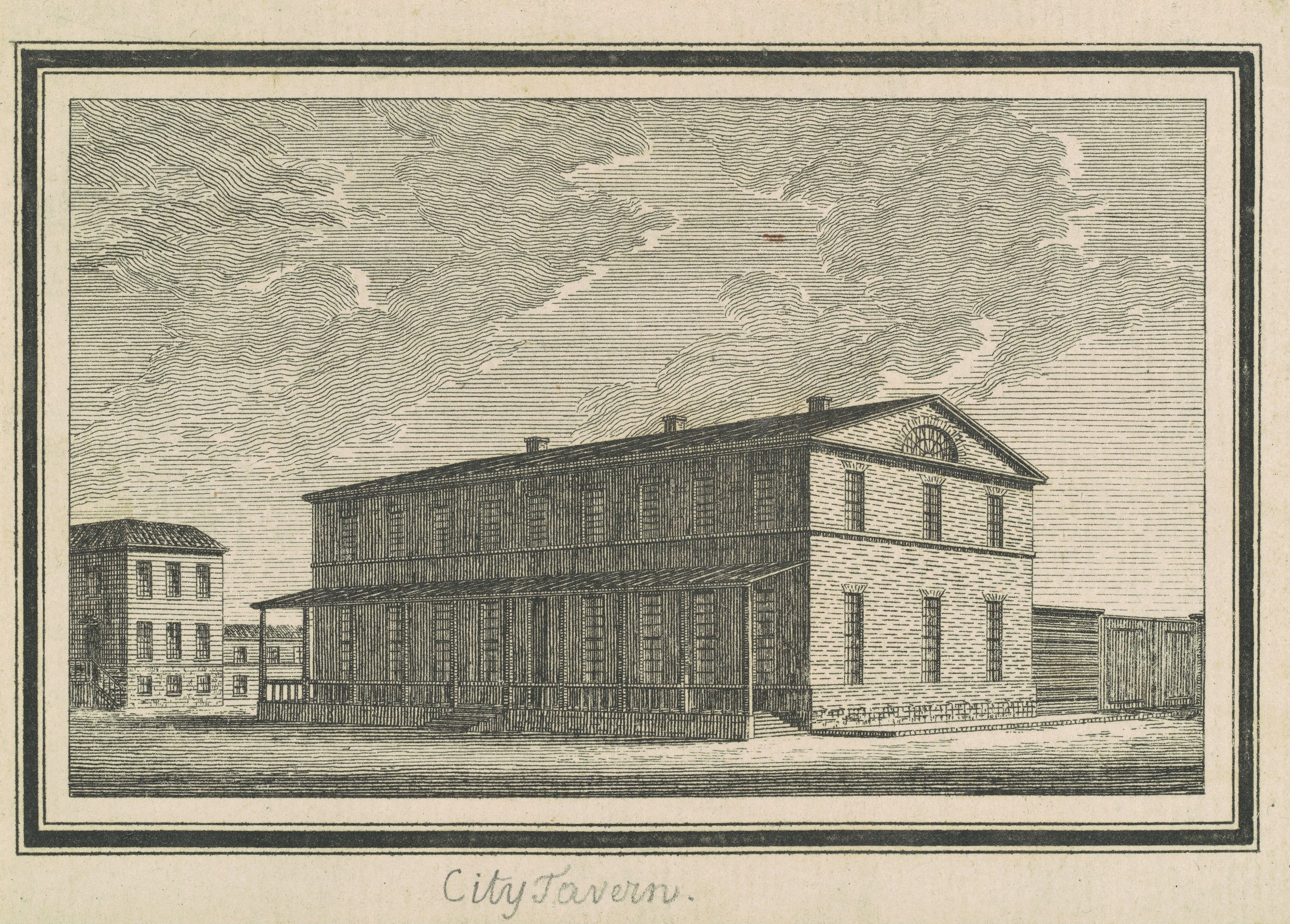
Charles B. J. Févret de Saint-Mémin, Esperanza City Tavern, 1795. National Gallery of Art, Corcoran Collection (Gift of William Wilson Corcoran).
The Three Images above were all engraved by Charles Balthazar Julien Févret de Saint-Mémin as part of his efforts to prepare enticing promotional material in partnership with Pierre Pharoux for their patrons who were developing a planned community on the banks of the Hudson at modern Athens, New York. These buildings, (which were never realized) offered potential investors a glimpse of the beautiful opportunity offered by the latest trends joining modern architecture with urban planning - in essence realizing the ideals of the new American republic in brick and mortar.
Questions and comments can be directed to Jonathan Palmer, Greene County Historian, via archivist@gchistory.org

Stereographs of the Catskills
A discussion of stereographs and the early practitioners of stereography in the Catskills.
Rapid advancements and innovation continuously redefined the field of photography throughout the mid-19th century. Improvements in camera and lens designs, changes in chemistry and technique, and the ever-growing appetite of the viewing public for affordable quality images drove photography from fringe curiosity to the forefront of mass media within twenty years of its introduction. Stereography, a photographic technique by which the viewer is tricked into perceiving a single three dimensional scene from two juxtaposed images, was an early and almost magical addition to the repertoire of accomplished photographers in Europe and America. Within a decade following the first demonstrations of the principle of stereopsis by Charles Wheatstone in 1838 there were practitioners utilizing the earliest and most rudimentary photographic techniques to render people and scenes in three dimensions with varying degrees of success. Continued refinement and the increased availability of cheap stereoscopes allowed stereographs to evolve from fringe luxury items to affordable and ubiquitous parlor companions around the world.
In Antebellum America the Catskills were already a celebrated and storied vacationland. These relatively accessible mountain environs had been elevated to something of a national treasure in works by painters and authors, so the area naturally attracted photographers almost immediately following the world introduction of the daguerreotype. A choice few of these practitioners composed early stereographs which survive to this day as one-of-a-kind expressions of their technique and artistry. These stereographs were a fascinating product. Using a stereo camera two lenses would simultaneously expose subtly different angles of the same scene on a wet (or later dry) photographic plate to create an image. Using those two lenses spaced roughly six centimeters apart allowed the camera to “see” much the same way the spacing of our eyes facilitates perception in three dimensions. Early practitioners apparently sometimes attempted this with a single lens by moving the entire camera slightly. The end result would appear like the first example below.
“Catskill Mountain House and Mr. John Allen’s Dog” by S. Root, 1854
This stereo Daguerreotype of the rear entrance to the Catskill Mountain House was audaciously composed by Samuel Root while visiting in 1854. Now heavily damaged with age, the two daguerreotypes within were not composed synchronously, leaving the image exposed in a different position on each plate. Even within a properly seated mounting the stereo effect would be minimally apparent, as the focus of each image is also substantially different. Daguerreotypes are one-of-a-kind, meaning Mr. Root’s effort to compose and mount the image resulted in only one salable item for his troubles. Collections of the Vedder Research Library.
“The Lower Falls at Kaaterskill” Photographer Unknown, c. 1855
This damaged stereo Ambrotype of the lower falls at Kaaterskill represents an intersectional period of innovation in stereoviews. The Ambrotype is essentially a glass negative mounted on velvet to create a unique single positive composition. However, unlike the stereo Daguerreotype by Samuel Root, this image was composed using a single treated plate and a stereo camera. Collections of the Vedder Research Library.
“The Mountain House from the North Mountain” by Frederick Langenheim, 1855
Frederick Langenheim of Philadelphia patented a technique to render bright, translucent images backed by frosted glass in 1850, calling it the Hyalotype. This 1855 image of the Catskill Mountain House, one of a trove of stereo views Langenheim composed on different media, offered lifelike luminance when viewed by a window in addition to the nicely executed stereoptic effect. The Hyalotype, an advancement of the Calotype technique, allowed Frederick and his brother to market copies made from an exposed negative through a form of contact printing. Collections of the Vedder Research Library.
Stereographs, like all other photographic styles, benefitted immensely from the innovation of new and improved negative-positive print techniques. The Langenheim brothers of Philadelphia had met with considerable success using the Calotype technique and the Hyalotype technique (which they patented) to offer stereo views on paper and glass prior to the Civil War, but the albumen printing technique finally made negative-positive printing accessible broadly to the photographic community on the eve of the Civil War. As the Civil War raged people across the nation were suddenly able to purchase images of great statesmen and generals, or commission multiple duplicate images of themselves and friends for nominal fees. This simultaneously made photography more affordable for the subject and more lucrative for the photographer. The stereograph was adapted quickly to an albumen print format with remarkable success, and the Catskills suddenly became an affordable destination which could be comfortably reached from anywhere in the country by simply sitting in the parlor with a stereoscope.

Oliver Wendell Holmes designed this affordable stereoscope before the Civil War and never patented it, allowing copycats to make these viewers affordably for the benefit of a public craving stereograph images. Mounted in the viewer is an E. & H. T. Anthony stereograph c. 1873 showing ice formations at Kaaterskill Falls.
Among the most prolific of the firms creating and publishing stereographs of the Catskills were Edward and Henry T. Anthony (E. and H. T. Anthony & Co.) of New York and John Jacob Loeffler of Staten Island. By all indications the Anthony brothers were the earliest of the two, but their portfolio was far more encompassing than just selling scenery of the Catskills. They funded and published some of Matthew Brady’s work during the Civil War, and sourced images from across the country in an effort to appeal to a broad audience who may not have necessarily had the money to travel but had the money for a stereograph. Edward and Henry Anthony’s main source of income was in the sale of photographic supplies, and they were one of the largest US-based sellers in the mid-19th century.

“Looking Down the Kauterskill, from New Laurel House” Scene 4202 from The Glens of the Catskills by E. & H. T. Anthony & Co., c. 1865; Collections of the Vedder Research Library, item PC-0000-0022-0034.
The earliest of the Anthony brothers’ Catskill Mountain scenery may date to the Civil War, but their work, much like that of J. Loeffler, is exceedingly difficult to precisely date. This is because much of their promotions, sales material, and business records apparently longer exists or are otherwise inaccessible — so while we know they most certainly had a collectible stereograph series called “Glens of the Catskills,” we don’t know precisely when they first advertised it or when they took the pictures to create the series. In many cases older images from other series could be incorporated into new collectible series, meaning an image originally published in the late 1860s could still be making the rounds in the 1880s if it was a good seller.
The Getty Museum dates some of E. and H. T. Anthony’s stereographs as early as the beginning of the 1860s, meaning that at least a selection of the Anthony portfolio was created using wet collodion plates that had to be prepared, exposed, and fixed on-site in the woods where the picture was taken. Their groundbreaking and unusual winter scenery, which they published several versions of in the 1870s, were probably done using dry plates which would have been far more forgiving in freezing temperatures. In fact the advent of dry plate stock in the early 1870s may have been the only thing that made their very novel winter series of stereographs possible, hence their appearance following the invention of dry photographic plates.

“View from Sunset Rock, looking East” Scene 265 from Artistic Series: Winter in the Catskills by E. & H. T. Anthony & Co., c. 1873; Collections of the Vedder Research Library, item PC-0000-0022-0003.

“Caves of the Ice King under Kauterskill Falls” Scene 274 from Artistic Series: Winter in the Catskills by E. & H. T. Anthony & Co., c. 1873; Collections of the Vedder Research Library, item PC-0000-0022-0009.
John Jacob Loeffler’s work in the Catskills, while more or less concurrent with the Anthony Brothers, is even more difficult to date because there is comparatively much less information available about him. A subsequent article will consider one of his images, the location it was composed, and how this can be used to facilitate an understanding of Loeffler’s artistic vision and a rough date of composition.
By Jonathan Palmer, Greene County Historian
Questions and comments can be directed to Jon at archivist@gchistory.org

A Palenville Footbridge
Identifying the location of John Jacob Loeffler's stereo view "Foot Bridge Near Griffin's Store" taken in Palenville, NY.
E. & H. T. Anthony & Company’s dominance in the Stereoviews market in the years following the Civil War left plenty of room for niche photographers to make their mark. John Jacob Loeffler of Tompkinsville, Staten Island, was one such practitioner who availed himself of the chance to compose stereographs of scenes sometimes off the beaten path and overlooked by his peers. Across the Catskills he captured countless images of both the majestic and rustic, creating what would become an authoritative catalog of some of the most iconic corners of this celebrated vacationland. All indications seem to point to his catalog of work being considerable in scale, but today relatively little is known of him and his artistry. The Library of Congress offers seven images by him in their catalog, and a few miscellaneous websites purport to have scattered selections of his various stereographic series.
None of these resources offer definitive dates of publication for Loeffler’s images; instead they offer broad circa dates covering the 1860s and 1870s. As discussed in my last article on the topic, dating stereographs so broadly over this date range has profound implications if one needs to understand the photographer’s process and technique, because taking a picture in 1860 was a vastly different experience than it was even fifteen years later in 1875. The monumental changes that occurred in the development of the Northern Catskills following the Civil War also meant that within twenty years many published stereographs showed scenes that were gone or otherwise transformed beyond recognition. Add another century and score to that and historians looking at Loeffler’s views are sometimes hard pressed to determine where a picture was taken, let alone a precise date of composition. One such example of a mysterious Loeffler image is a stereograph of a small pedestrian bridge in Palenville.
![J. Loeffler’s Stereograph “[Number] 297, Foot Bridge, Near Griffin’s Store, Palensville [sic]” from Catskill Mountain Scenery, Fourth Series. Undated but likely circa 1870. Image PC-0000-0021-0068, Vedder Research Library.](https://images.squarespace-cdn.com/content/v1/59d3dc3ae9bfdfba3b1b9958/1634564945764-ANEVNADBMUFLZY0MULN8/PC-0000-0021-0068.jpg)
J. Loeffler’s Stereograph “[Number] 297, Foot Bridge, Near Griffin’s Store, Palensville [sic]” from Catskill Mountain Scenery, Fourth Series. Undated but likely circa 1870. Image PC-0000-0021-0068, Vedder Research Library.
The scene is rather inconspicuous, as it shows a small crossing of the Kaaterskill Creek in a working class corner of Palenville downstream from the Clove and its popular natural scenery. There are no mountains in the background, indicating that the scene looks downstream and eastward. None of the buildings are recognizable, and were it not for the fact that the stereo card’s reverse said “Foot Bridge, Near Griffin’s Store, Palensville [sic]” one would be hard pressed to say the scene was in Palenville at all.
Fortunately the clues given in Loeffler’s description were enough to locate the general vicinity of “Griffin’s Store” on the 1867 atlas map of the Town of Catskill. On that map appear several buildings and manufactories owned by “G. & S. T. Griffin” on both sides of the Kaaterskill north of the Malden Turnpike at the southeast end of the hamlet. One of the buildings they owned was a chair factory near the home of G. Griffin, several others may have been worker’s housing, and one is shown as S. T. Griffin’s (probably his house) nearby their store. Interestingly, a stone rubbing mill is nested alongside the Griffin complex on a small dead end path near the turnpike. No informal crossings like the one in the picture are shown on the 1867 atlas, but with businesses and family homes on both sides of the Kaaterskill creek it is not surprising that the Griffins may have had a foot bridge to allow workers and themselves easy access between properties.

Detail from the 1867 Atlas of Greene County showing the hamlet of Palenville within the Town of Catskill. Giles Griffin and Samuel Griffin’s expansive complex of homes and workshops can be seen above the Malden Turnpike.
In the 1865 Census of New York State both Giles Griffin and Samuel T. Griffin are listed as merchants and heads of households in Catskill’s Third District. Theodore Teal, another Palenville resident, was the enumerator for the third district. Many of the people listed in Griffin’s neighborhood were European immigrants, and the occupations given alongside their entries offer a window into the composition of the community around Samuel Griffin’s house and store. One neighbor of Griffin’s named Archibald Davis was a chair maker, possibly living in one of the homes shown near the chair factory; neighbors John Graff and Jacob Baslee were tanners who may have been employed at the tannery opposite their homes over the wooden footbridge in Loeffler’s stereograph; also close by were James and Isaac Newkirk, stonecutters. Margaret Herald, the 38-year-old German wife of Augustus Herald (himself age 48 and from Russia), gave her occupation as “Tanner” as the only employed member of their household. All of these people living near Griffin’s Store and the wooden footbridge seem to have worked within view of their front doors.

Entry from the 1865 New York State Census showing Margaret Herald listed as a Tanner. Enumerator Theodore Teal’s script employs a more highly stylized uppercase “F” compared to his uppercase “T,” otherwise the words “Tanner” and “Farmer” would be entirely conflated.
On a preceding page we find Giles Griffin, also a merchant, living alongside wood turners Aaron Smith and Albert Craft. Two other neighbors named John Mower and Peter Craft were stonecutters. The stonecutters who lived near Giles and Samuel are most intriguing, as it was likely all these men were either employed in nearby bluestone quarries or at the stone rubbing mill near Griffin’s store itself. Stone rubbing mills were a facility for finishing quarried bluestone before reaching market, though they were often run by middlemen and located near docks on the Hudson.
A NYS Museum Bulletin from 1903 describes in considerable detail the operation of bluestone quarries in the northern Catskills — listing different grades and types of bluestone, their uses, and the finishing processes employed to make the stone marketable. It is possible that the rubbing mill in Palenville was devised to cut out middlemen at the river landings and help get quarrymen more revenue for their work. Whatever its objective, this stone rubbing mill helps definitively place Loeffler’s stereograph of the footbridge, because in the background to the right on both views can be seen piled bluestone and tailings which would have been typical of the reduction debris and unprocessed stock seen at a rubbing mill.
![Detail of the right image from Loeffler’s stereograph showing stacked Bluestone and reduction debris behind the Rubbing Mill. From J. Loeffler’s “[Number] 297, Foot Bridge, Near Griffin’s Store, Palensville [sic]” from Catskill Mountain Scenery, Fourth Series. Undated but likely circa 1870. Image PC-0000-0021-0068, Vedder Research Library.](https://images.squarespace-cdn.com/content/v1/59d3dc3ae9bfdfba3b1b9958/1634565718518-QDPX9RLAS29AA9YSQF7O/Screen+Shot+2021-10-18+at+10.01.40+AM.png)
Detail of the right image from Loeffler’s stereograph showing stacked Bluestone and reduction debris behind the Rubbing Mill. From J. Loeffler’s “[Number] 297, Foot Bridge, Near Griffin’s Store, Palensville [sic]” from Catskill Mountain Scenery, Fourth Series. Undated but likely circa 1870. Image PC-0000-0021-0068, Vedder Research Library.

Based on the description Loeffler gives for his stereograph and clues present in the images themselves the above marker and arrows illustrate the probable location where “Foot Bridge Near Griffin’s Store” was composed. South of the photographer’s position appears Griffin’s store. The bridge further upstream is not an alternate candidate, as it wouldn’t allow for the appearance of the rear of the Rubbing Mill. Likewise the Tannery would be too close, but the Griffin's chair shop is more correctly spaced.
What remains unknown is a precise date for Loeffler’s scene, because the rubbing mill in the 1867 atlas may have operated for several years prior and subsequent to the atlas’ publication and there are no other features shown which would narrow the date beyond the period between 1865 and 1875. We do however have a much clearer idea of the exact location of this scene as well as the social makeup of the neighborhood surrounding Loeffler’s footbridge. It is interesting that Loeffler, in a departure from typical stereographs showing scenes of natural beauty, prominent buildings, and locales often only accessible to people of means, would decide to compose a view of a rustic and utilitarian footbridge in a predominantly immigrant neighborhood of a working class Catskill Mountain hamlet.
By Jonathan Palmer, Greene County Historian
Email Jon with questions via archivist@gchistory.org

Women's History Month
Celebrating the life of a woman from East Jewett for Women’s History Month.
Alvena Hitchcock passed away this month at the formidable age of 103. Her obituary was an unwelcome sight when Patricia Morrow posted it on Facebook, because somewhere deep down I had the faint hope that one day I would have the chance to meet her. Instead this Women’s History Month marks the passage of a remarkable woman, and we are diminished by her departure. East Jewett has lost one of its matriarchs.
She came up in conversation at work the same day I read the news. Larry Tompkins, unknowingly mirroring her obituary, immediately remarked on his memories of seeing her seated next to the immaculate antique wood-fired Glenwood Stove in her kitchen. Mrs. Hitchcock’s obituary spoke of her sitting beside it reading her mother’s diaries. Larry and I contemplated in conversation the thought of her cleaning and keeping that wood cook stove burning well into her twilight years - a remarkable feat in and of itself.
That stove was not Mrs. Hitchcock’s defining feature, but it was an apt symbol of what she embodied. Over the years she assumed the roles of scholar, musician, historian, community volunteer, mother, and wife - fulfilling the responsibilities entailed by each while at the same time carrying forward memories of the Mountain Top as she knew it a century ago. Through her those bygone days were still alive for all of us, stoked to life every time she put a log in the Glenwood stove and recollected to a neighbor the memories of their departed forebears. Those forebears and ancestors were people she had known in life, and they endured for those neighbors in her spoken recollections much the same way Mrs. Hitchcock’s mother endured for her through those old diaries. I’d like to think Alvena Hitchcock understood the responsibility Time had bestowed on her and that she relished the importance of it.
Women’s History Month as I knew it growing up didn’t celebrate women like Mrs. Hitchcock. In school we read about historical figures like Susan B. Anthony, Harriet Tubman, Amelia Earhart, and Nellie Bly to name just a few - but our grandmothers, mothers, and sisters were not on that list; our family, neighbors, and teachers weren’t part of the curriculum. Perhaps this nuanced understanding was a bit much to expect from an elementary schooler, but that doesn’t mean we can’t strive now to reconcile that dissonance.
I have no doubt the list each of us could make for our revised Women’s History Months would be formidable in scale. My own would start with family, but it grows quickly to include a multitude of neighbors, friends, coworkers, mentors, and predecessors in my given profession as an historian and archivist. The domain of local history in particular is populated with countless women chroniclers whose silent work collecting, preserving, and interpreting our community heritage goes unacknowledged with alarming frequency.
The scrapbook collections of the Vedder Library are a prime example of this. Cataloged and partially indexed, you can find wonderful bits of trivial information and anecdotes scattered among their tattered pages. However, no catalog description fully explains that each volume is really a curated exhibit compiled by a local woman with an eye for posterity. Within a single scrapbook’s pages we get to experience the communities and lives of these often unnamed chroniclers as they saw fit to document in their time. What I mean to say is that by opening the pages of these crumbling tomes we modern observers get to have a conversation with these women again, reading of the past they quietly clipped from newspapers and interpreting their work for the present.
The scrapbook collections are only one small portion of the vast contributions women have made to the documentary heritage of this county. The Vedder Library itself, named for our first County Historian Jessie Van Vechten Vedder, serves as an indelible reminder of her monumental efforts - foremost being that she set a bar so high many of her successors, myself included, can only look on in awe in lieu of surpassing her achievements. And then of course there are some books resting on a shelf in the opposite aisle from our scrapbook collections; several histories by the late Elwood Hitchcock regaling us with bygone days of the Mountain Top. Alvena Hitchcock, Elwood’s wife, typed all his books up from notes during her free time in preparation for the publishers. Here’s to the memory of Alvena Hitchcock sitting beside her old Glenwood stove on this Women’s History Month.

Alvena Hitchcock sitting beside her antique wood cook stove in an undated newspaper photo from the mid-2000s. Image courtesy of Larry Tompkins.
By Jonathan Palmer, Greene County Historian.
Questions and comments can be directed to Jon via archivist@gchistory.org

The Noon-Mark
The title for a new column is revealed in the retelling of an old folk tradition recorded in Rev. Henry Prout’s “Old Times in Windham.”
A noon-mark is a traditional method used to track the passage of time.
[This article was originally published as the inaugural column in a feature titled “The Noon-Mark” for the digital newspaper Porcupine Soup, you can read those features through this link.]
I’ve been all bent out of shape trying to come up with a title for this newly inaugurated column, and now that I’ve finally arrived at one I have little doubt most of you are thinking “… that’s it?? It took you two weeks to come up with that?” — my reply to which is simply “yeah."
Like anyone faced with a vexing problem I sought sage counsel, but when I mentioned to my own mother that I had no clue what to call this prospective weekly feature she insightfully declared “You could call it ‘Fresh from the Jon.’” While allusions to the toilet probably don’t set the right tone I have little doubt that her kind suggestion was probably an apt one, though I leave it to you all to be the final judge of this. I only ask that you make the determination of this feature’s worth after a few issues and then decide if it should be carried on or canned.
So what the heck is a noon-mark? Truth be told I had never heard of one until about a week ago. I was up late reading “Old Times in Windham” by the Rev. Henry Hedges Prout, and stumbled across his reminiscence of an age before any of the earliest settlers of Windham had a clock among them to tell time. As a generally industrious lot of people it was still useful to track the passage of the day, so in lieu of a clock a tool called a noon-mark was employed.
Here’s how noon-marks work — In a sunny window of a cabin a gouge would be carved at the edge of a shadow cast by a fixed object when the sun was at its highest point in the sky. This gouge could then be used day by day to find a rough approximate of noon… as the shadow approached the mark it was the forenoon, and as it moved beyond the mark it was the afternoon.
Naturally, a noon-mark is only most accurate during the season it is carved, so I suspect these settlers probably had a summertime noon-mark and a wintertime one to account for the shifting of the sun’s position in the sky. While the noon-mark was doubtlessly primitive, it certainly sufficed to help track the day, and the people of that time were none the worse for wear through its use.
History, like the noon-mark, is an imprecise thing. The passage of time makes the exact recollection of many things impossible, and we are forever trying to track our own progress as a people by the veiled memory of the past. History then is really just a noon-mark for a different scale of time, and I suspect Rev. Prout would have agreed with my analogy.
I have no idea what this column will hold in store. I don’t aim to make it “all history, all the time” and certainly don’t have the ability to guarantee you’ll see it every week, but I do promise it will be the best I can muster. In the meantime I highly recommend you find a copy of Prout’s “Old Times in Windham” and give it a read.
By Jonathan Palmer, Greene County Historian.
[Banner image is a scene showing the ruined remnants of a settler’s cabin high in the mountains between Jewett and Windham. Palmer Photo.]
Questions and observations can be directed to Jon Palmer via archivist@gchistory.org

RUN IF YOU SEE THIS MAN
Election shenanigans culminate in newly elected Judge Malbone Watson beating the snot out of someone.
In a previous article I offered weak assurances that eras of great political and social turmoil are pretty much par for the course in our democratic system. I spoke at length on one particular manifestation of this long tradition of divisiveness by expounding on the the circumstances surrounding the rather audacious naming a new town in Greene County “Ashland” in 1848. For those of you who still harbor strong opinions about Henry Clay I’m sure you were thoroughly convinced of the merit of my argument, but I understand that there are many of us who no longer harbor convictions of any sort concerning the Whig platform.
In light of that I convey a highly abbreviated summary of a sketch by the late Mr. Jesse W. Olney about his grandfather the late Justice Malbone Watson of Catskill, the latter of whom’s experiences as an elected official in the Jacksonian period left him so withered and distraught following an election in 1847 that he quite literally assaulted the first person who offered congratulations to him as a newly elected Judge on the New York Supreme Court.
In case you were unaware - backdoor political dealings, unsavory party machinations, and electoral ambushes were just some of the things that made politics in New York a rather unpleasant business in the 1830s and ‘40s. Malbone Watson, a thoroughly well-regarded lawyer from Catskill, was nominated to run for a vacant post on the Supreme Court in 1847. He accepted of course, knowing the nomination was a complement by his peers and a natural advancement for a lawyer of his regard.
Mr. Olney, while perusing selections of his grandfather’s old papers, speaks glowingly of his ancestor’s intellect and character: “… Latin verses composed in such a scholarly vein that I have been unable to translate them. His verses in English, however, were filled with witticism and satire of the keenest relish… these little fragments all show Mr. Watson’s warm appreciation of all that was good in life, always the bright happy side… this was the prevailing characteristic of Justice Watson — live the life of the day with all its pleasures, and enjoy it to the full.”
Following the ratification of the new New York State Constitution in 1846 pressure was great among Whig and Democratic factions to place a judge of their party on the Supreme Court seat in the district which included Greene and Columbia County. To summarize the contest for the Bench in 1847 Mr. Olney writes: “The low cunning and trickery practiced towards Mr. Watson has seldom been equaled in the political annals of the State.” There was an effort to suppress public awareness of his candidacy, attempts by factions of both parties to edge him out of potential votes, and quite possibly some mishandling of ballots (though this is uncorroborated). The end result was that when the election finally rolled around in June Mr. Watson cast his ballot and stormed off into the Catskills for several days to be alone with his thoughts. Much to everyones surprise when the ballots were counted Mr. Watson came out as the clear victor - a result many would not have predicted - however, the newly minted Judge was nowhere to be found.
A week passed, and word had not yet reached Judge Watson through official channels when a passerby spotted Watson storming back along the road to Catskill looking haggard and unwashed from his days in the hills. Not knowing the circumstances of the Judge’s ignorance to the good news, the man called out “Good Morning, Mr. Justice Watson!” In a fit of rage at what Watson supposed to be a rather mean-spirited jab at his electoral defeat he quietly approached the greeter, promptly dispensed with his coat and proceeded to unapologetically thrash the man for several minutes until neighbors intervened. To say that the Judge felt the need to make one last statement about his heinous treatment at the hands of local party bosses would be an understatement, and I would love for any reader to offer a tale of local election shenanigans to top this anecdote of a Supreme Court Judge beating one of his constituents to a pulp for offering a kindly salutation.

The esteemed late Honorable Malbone Watson of Catskill from a copy of a daguerreotype of him taken c. 1850.
By Jonathan Palmer, Greene County Historian
Questions can be directed to Jon at archivist@gchistory.org

Ashland and the Whigs
The name of a small town in the Catskills is a product of the political strife of a different age.
Living in historic times is no fun. The following article is something I originally wrote back in August of 2020 for the Catskill Daily Mail, and it opened with a naive intro in which I assured readers that precedence for current events could always be found in the past. That is most certainly true to some degree, but it is a rare thing indeed when one is forced to reference a bibliography’s worth of scattered events from the last two centuries of our history to explain the insidious absurdity of the past twelve months. I suppose we can at least take heart in knowing that neither Trump nor Biden has ever made a personal habit out of shooting people they disliked. It is also nice that none of our current congresspeople have yet beaten a fellow congressperson to within an inch of their life during a floor debate. Perhaps we can at least chalk those two episodes up as “lessons learned.”
Indeed, our forebears didn’t need to contend with conspiracy theorists sacking the Capitol, nor with pandemics run amok and fanned to flames by the perpetuation of lies, but we ought to give ourselves a break… we can’t always compare ourselves to great-great grandparents who were mystified for quite some time by fecal contamination of drinking water. If we want to merely assuage our fears about political divisiveness and ascendant demagoguery we need look no further than the Town of Ashland as our Balm in Gilead. Ashland is a product of a political climate as fraught as ours, though on the whole our forebears carried on political strife with more panache.
To speak on the Town of Ashland as support for this thesis might seem a bit of a stretch, but that is only because we’ve failed to consider the town’s name. By even our standards the situation that led to its selection in the spring of 1848 must have been tense. To understand how Ashland got its name we must first speak of Henry Clay; plantation owner, statesman, three-time presidential nominee, and most importantly a founder of the Whig Party. Ashland was the name of Clay’s plantation, seen by his political acolytes as the seat from which sprang all Whiggish theory and goodness in antebellum America. Andrew Jackson and his Democrats spoke of Ashland and Mr. Clay in less glowing terms.
Which brings us to our dear friend and late county resident Zadock Pratt, Jr. — the son of a Revolutionary War veteran and the man who singlehandedly transformed the sleepy hamlet of Schoharie Kill into an epicenter of the Tanning Industry in the United States. Pratt’s influence was formidable and his followers many. His industrious nature rewarded him with seats in the Federal Congress in 1836 and 1842, and he even sought the nomination for Governor of New York in 1848. Additionally, Prattsville, an incorporated township, was carved out of Windham in 1833 and humbly named for its premier resident and benefactor.
Pratt was a Democrat, aligned lock-step with the Democratic administrations of Jackson in the White House and Van Buren in the Governor’s mansion at Albany. A visitor to Prattsville at the height of Pratt’s power remarked on how Whigs setting foot in the hamlet in the mid-1840s were given the silent stare-down by residents and storekeepers on main street until they took the hint to move along. Prattsville residents wanted little to do with Clay and his Whigs.
Such was the political climate in the western part of this County at the height of the age of Jackson. Massive political rallies by the Whigs in Catskill were starkly contrasted at the western end of the County by continued electoral success of Zadock Pratt and his Democrats. The newspapers, rather than operating under the illusion that they were supposed to stay neutral in political discussion, quite literally made wagers of large sums of money in bets against rival editors. The Messenger, Catskill’s Whig newspaper, never missed an opportunity to make a jab at the Advocate, Prattsville’s Democratic publication.

Editorial from the Catskill Messenger concerning the formation of Ashland in 1848.
The creation of Ashland, named for Clay’s Kentucky home, was a blow to the political status quo in Greene County. Formed “from the Whig portion of Windham” as one editor put it, this new town quite possibly meant another opposition seat on the County Government. The Democrat, a newspaper in Catskill, morosely speculated that perhaps by sequestering all of the Whigs formerly of Windham in a new township that Windham may in the future simply become one more Democratic Seat. Regardless of the outcome, the advent of the formation of Ashland had to be seen as a low blow by Zadock Pratt’s friends in Prattsville. To think that Henry Clay, who had never lifted a finger for the betterment of Greene County, could be honored by the naming of a new township must have rankled those who knew the effort Pratt had expended in the creation of the town that bore his name.
And thus, over 170 years later, we are still saddled with the trappings of one small aspect of the great political contests of the Jacksonian era. While such stirrings of the past may seem to pale in comparison to the present, I humbly offer in conclusion that despite everything these last few years have thrown at us we have yet to hack apart any of our current fourteen townships in the sole name of political gain.
By Jonathan Palmer, Greene County Historian
Questions can be directed to Jon at archivist@gchistory.org
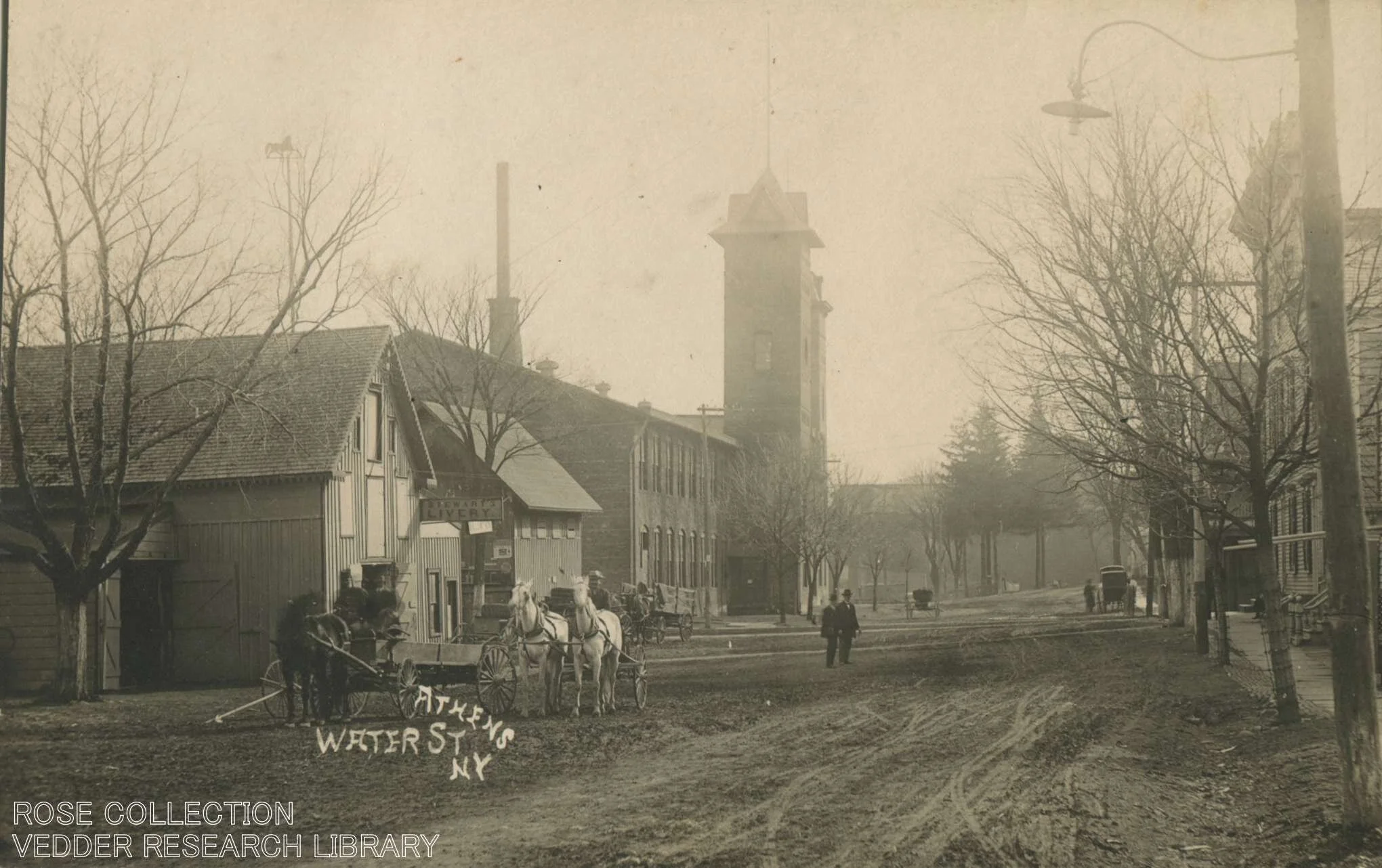
Kadin Brothers Pocketbook Factory
A brief history of the Athens Knitting Mill and Kadin Brothers pocketbook factory at Athens, New York.
The riverfront at Athens is celebrated by residents and visitors alike as its most beautiful asset, but its modern appearance and recreation-oriented amenities bely the riverfront’s original function as the epicenter of all of the Village’s industrial ventures. The Athens Riverfront Park, one of the Village’s cornerstone features, is a prime example of this relatively recent transformation. At the park today folks can enjoy weekly summer concert series, an annual festival, quality drinks and food at nearby restaurants, and quick access by boat via the village docks to attractions such as the Hudson-Athens Lighthouse.
Old timers and lifelong residents will of course recall when this was most certainly not the case, pointing to a time over forty years ago when the riverfront park was merely the footprint of the looming Kadin Brothers Pocketbook Factory. Where welcoming picnic tables now offer shaded seats below the park’s trees there once loomed towering brick walls and a bell tower that left Water Street in shadow for half the day. From within emitted the hum and clang of industrial sewing machines, carding machines, looms, and packing rooms where residents from Athens and Hudson found steady work in shifts manufacturing products for a ready market in New York City.
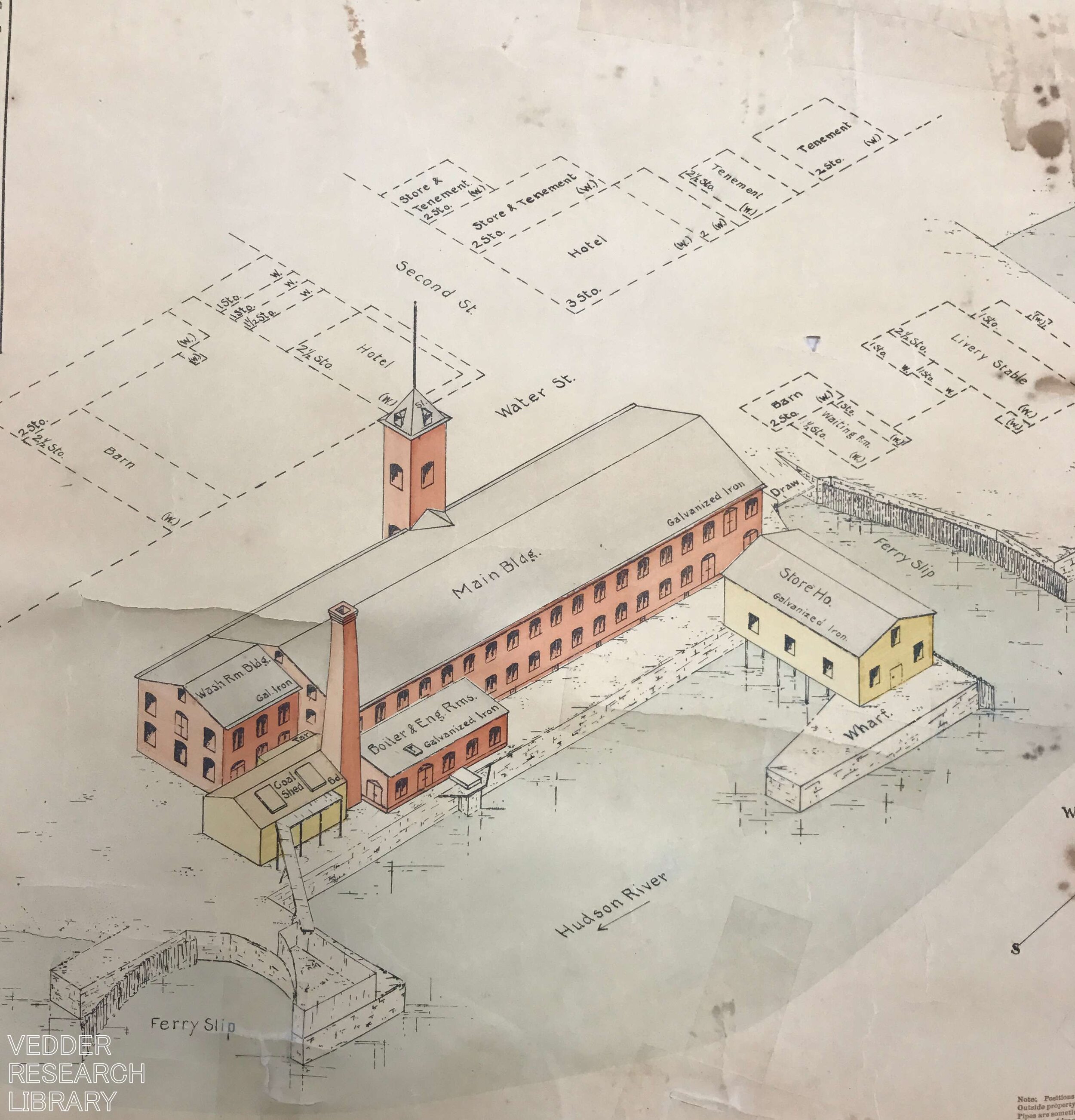
Plan of the Athens Knitting Mill in 1896.
The Pocketbook Factory, as it is still recalled by many residents, has a story much older than that of the the Kadin Brothers firm which operated the Athens plant from 1937-1968. It begins in the 1890s when large regional manufacturing concerns dominated America’s economic landscape. This factory, which was originally known as the Athens Knitting Mill, sprang up as a textile plant around 1896. It replaced several old storehouses and expanded a historic wharf at that location, and was ideally sited hard by the slip of the Hudson-Athens Ferry. Its location presented an opportunity to source labor from not only Athens, but the City of Hudson as well.
It is not known what was originally manufactured in the Athens Knitting Mill, but an interior postcard of the Mill taken sometime before 1910 shows some of the belt-driven carding machines on one of its floors, indicating the processing of wool for garments or blankets. A dock offered ready access for barges bringing raw materials and taking away finished products, a handy feature which probably factored in the Mill being sited there. Generations of Athenians found work in the mill on the manufacturing floors, in the machine shops, and in management roles. Despite its formidable size, the Knitting Mill was still only one of several manufacturing and service industries that made Athens a robust working community for the first 150 years of its existence.
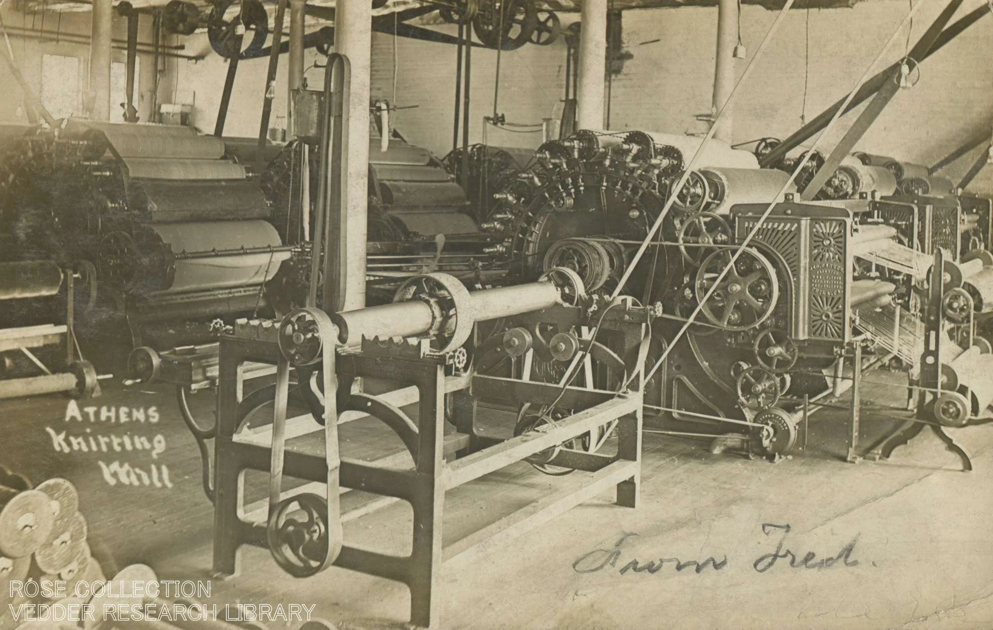
Interior of the Athens Knitting Mill showing some belt-driven carding machines circa 1910.
The Knitting Mill was offered for sale in the mid-1930s and Kadin Brothers, a firm based in New York City, saw an opportunity for expansion. They purchased the plant and moved their manufacturing operations up the river to Athens. Kadin Brothers existed as a company 1924 to 1992, touting international designers and a “Made in the USA” tag on their products which were mainly women’s handbags and pocketbooks. The company’s products competed successfully for decades against a slew of other affordable and fashionable women’s handbags while also offering frame bags and other items of a more utilitarian function that sported the company’s sensitivity to the latest styles. In the 1940s and ‘50s the wives of several Athens Village officials were always pleased around the holidays to find a complimentary handbag from company management on their doorsteps.
When Kadin Brothers purchased the old Knitting Mill building it was in desperate need of upgrades. An announcement from a local paper in 1937 noted that the machinery needed to manufacture handbags was being shipped up the Hudson from a decommissioned Kadin Bros. plant in Phillipsburg, New Jersey. Local contractors were hired to make improvements to the physical plant and electrical systems, and by the end of the year the Athens factory was employing 150 women and 50 men - a welcome new source of employment in the depths of the Depression. These employees and the staff of a similarly scaled plant in Hudson were unionized, and the successfully fought for pay raises the year after the factories commenced operation.

The Athens Knitting Mill circa 1915.
Like countless manufacturing firms across the country, competition from cheaper overseas labor and the desire of managers to increase profitability led to the closure of the Athens plant in 1969. Kadin Brothers’ operations were consolidated with the Hudson plant, and the Athens Knitting Mill Building went dormant. The Village seized the factory for back taxes in the mid-1970s, and despite many ideas for repurposing the building (including an offer to convert it to apartments in 1975) no feasible plan came to fruition. Finally the Village decided to have the building demolished, and a contract crew removed the structure and components in 1978 at no cost to the community, leaving only a large concrete slab that would remain for several more years.
By Jonathan Palmer, Greene County Historian.
Questions can be directed to Jon at archivist@gchistory.org

Rally 'Round the Flag
Confederate flags in Upstate NY, government bans, and a little bit of frustration over the need to have this discussion.
“We’ll rally ‘round the flag, boys, we’ll rally once again -
shouting the battle cry of freedom”
~
Well folks, its after the first of the year and I’m pretty sure that marks the start of my tenure as Greene County Historian. It’s quite a thing, and here’s hoping I can keep after it. I figured I ought to start things off with a bang, and lo and behold Governor Cuomo went ahead and banned the sale of Confederate flags on State property. Now there is a lively issue! I couldn’t have imagined a better circus ring in which to toss my hat.
On a day not unlike today nine years ago I was but a young rube sitting in American History 101 at Columbia-Greene Community College. The professor sat with his feet up on the desk and a smirk as he asked us general questions about US History to gather what I can only assume was a sense for class density.
He went over the syllabus, eyeballed all of us, and asked: “When did the Civil War end?”
Several of us geniuses replied with the correct date, and some really iced the cake and gave names of notables and the place where Lee surrendered. The professor, feet still on the desk, looked at us with the mildly amused disappointment of a parent who has just watched their child accidentally jet themselves in the face with the garden hose.
“Wrong!” was all he said, and amidst flailing entreaties for him to explain further he supplied a different date: August 1965. The month the Voting Rights Act was passed into law.
I have a working theory called the “Three-Step Path towards Civil War Awareness” that I’ve been developing since that day nine years ago. Mind you, it’s only a theory, but gravity is a theory too. My theory postulates that we "history dorks” must go through three phases of awareness before we attain an enlightened understanding of the American Civil War. The first step is textbook awareness. This step is when we are told in grade school that the Civil War was about Slavery. Countless millions accept this as fact and remain blissfully planted at the start of the path never to march onwards.
Then there are those neophytes who dispense with this initial undertanding and move on to the second step. This is the “States Rights” step in the threefold path, and acolytes will brandish many curious facts and citations, and perhaps Edward Pollard’s “The Lost Cause” to back it up. They will say that one must read between the lines to discern the facts, admonishing others to “do their research.” Yet another countless million stop and rest comfortably at this step, loathe to move beyond Pollard and his Confederate apologies.
Finally, there are those who dare search further. These souls inadvertently complete a harmonious circle and finally arrive at the enlightened state titled “Oh geez, the Civil War really was about Slavery after all.”
This three-step path is borne from a fundamental failing in the way the Civil War is taught to American students. For a century children have languished in classrooms bored out of their minds as old men stood before them discussing battles, troop movements, and the peculiar temperaments of various generals. This is fine to an extent, and certainly fulfills the “War” part of Civil War curriculum, but it never gets at the gist of it. What is never mentioned is that everyone had been mad at each other essentially since 1787, and that the Civil War almost started in 1820, then again in the 1830s, and finally got rolling in the 1850s.
The crux of these myriad issues which led to bloodshed is still often described in the context of politicians reconciling state and federal power, or state sovereignty, or balance of power between the states. These descriptions make the antebellum period sound like an era of benign policy games concerning banks and territorial expansion, entirely divested of the identities of those filling the bank coffers and the people who lived in these expanding territories.
Indeed, what these descriptors touch at (but never distill to their essential truth) is that there was a fundamental ethical and cultural imbalance at play between Slave States and the so-called Free States that comprised our imperfect union. In essence, the core of the issue was that chattel slavery in America was an institution robed in nearly untouchable political power, was deeply economically entrenched, and fundamentally at odds with the Enlightenment soul of our democratic philosophy.
If that doesn’t quite hit it on the nose for you, oblige me by reading Alexander Stephens’ Cornerstone Speech in which the Vice President of the Confederacy rivetingly outlined the idealogical underpinnings and political objectives of the Confederacy, explicitly stating: “Our new government foundations are laid, its cornerstone rests, upon the great truth that the negro is not equal to the white man.”
After the Civil War myriad institutions sprang up across the nation to perpetuate the subjugation of African-Americans. The war had ended, but the peace was far from won. These sharecroppers, in a photo by Catskill resident James Van Gelder, are held in bondage in the 1880s not by chains, but by manipulative leases that tied them to the land they once worked on as enslaved labor in Louisiana.
And so we circle back to Governor Cuomo and his recent ban on the sale of the Confederate Flag on State property. There is urgency in the need to address the phenomenon his ban tries to tackle. There are fourteen townships in Greene County, and in practically every single one of them I have seen at least one Confederate Flag flying — be it on the back of a truck, on a flagpole, or hanging in a garage or on the side of a house. Alexander Stephens’ words flash through my mind every time I see one, and how can I not be driven to anything other than abject rage contemplating the scene? What is that doing on display in New York?
Of course a discussion of the Confederate flag’s symbolism, much like discussion of the War itself, can be robed and paraded in half-truths: “it is a symbol of rebellion” or “it is part of our heritage” and “you can’t erase history**” but at the end of the day the Confederate flag cannot be divested of its enduring original meaning. It is that root symbolism which inspires Klansmen to hoist it over their marches, and really — if you see the Ku Klux Klan waving it on the evening news why on earth would you want to display it too?
I really wish it were the case that the Civil War had ended in 1965. The passage of the Voting Rights Act that year was the greatest single refutation of the ideology of the Confederacy since Lincoln’s call for troops to suppress the rebellion in 1861. I will be curious to see if Governor Cuomo’s ban is challenged and survives the courts, and while I laud the spirit of his effort the best remedy probably lies in classrooms — not more orders from the Governor’s desk. A solution for now remains elusive, so instead we are left with the question: “why is this the flag you’ve decided to rally ‘round?”

Picture inside the US Capitol Building a few hours after I originally published this article. Photo by JIM LO SCALZO/EPA-EFE/SHUTTERSTOCK taken from an article published by People Magazine.
By Jonathan Palmer, Greene County Historian
Questions and comments can be directed to him via archivist@gchistory.org
**obviously you can’t erase history, especially when it is festooned on the front lawn scaring the neighbors.
![Fun at the Fenmore [Guest Feature]](https://images.squarespace-cdn.com/content/v1/59d3dc3ae9bfdfba3b1b9958/1609296613675-FON4S2CDXOWVG8AEMLYK/img20201128_11520245.jpg)
Fun at the Fenmore [Guest Feature]
Revisit the heyday of Catskill Mountain Resorts in this special feature by Jil DeMasi as she travels back in time through the camera lens of the Hallenbeck family as it captured candid moments around their summer resort in Haines Falls.
Revisit the heyday of Catskill Mountain Resorts in this special feature by Jil DeMasi as she travels back in time through the camera lens of the Hallenbeck family as it captured candid moments around their summer resort in Haines Falls. This installment is the most image-heavy of several features Jil has authored about her Hallenbeck ancestors, and you can find her other guest features through these links:
The Sundial Art and Novelty Shop
The Haines Falls Schoolhouse Comes Full Circle
FUN AT THE FENMORE HOTEL
BY JIL DEMASI
Fenmore means, “Dear Love.” As mentioned in prior stories, I imagine that my great grandfather, William I. Hallenbeck dedicated the hotel to his wife, Eva L. Burton Hallenbeck. It is apparent from ancient and faded pictures with serious to sad expressions, that father, mother and daughter, (my grandmother) Irene Eliza Hallenbeck, worked very hard. It does however, look like they squeezed in some time for fun at the Fenmore.
Was it the strenuous labor, a broken heart or just the expectation of the times – stoic and stern, that is reflected in the eyes of my ancestry? Wish I could ask. I don’t like sadness but, without it, we don’t appreciate happiness and happiness is a telescopic view to the mysteries of eternity. My pictures share Irene Eliza Hallenbeck with smiling friends and guests, enjoying comradery, and having fun at the Fenmore in the early 1900’s. So, just what could you do to have fun while visiting the Fenmore Hotel in Haines Falls? Here are 30 snapshots, no pun intended:
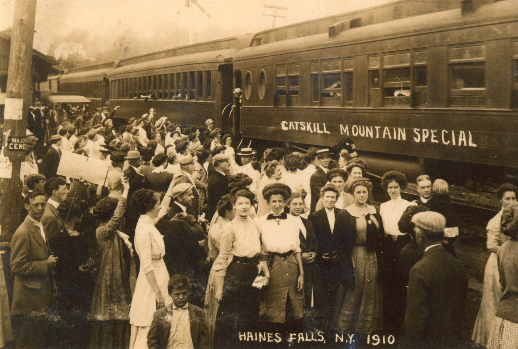
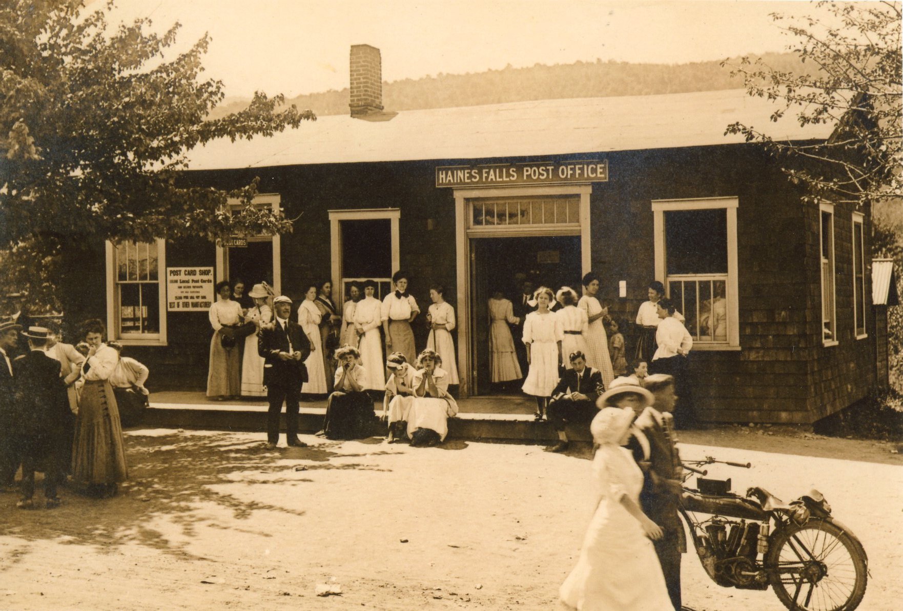
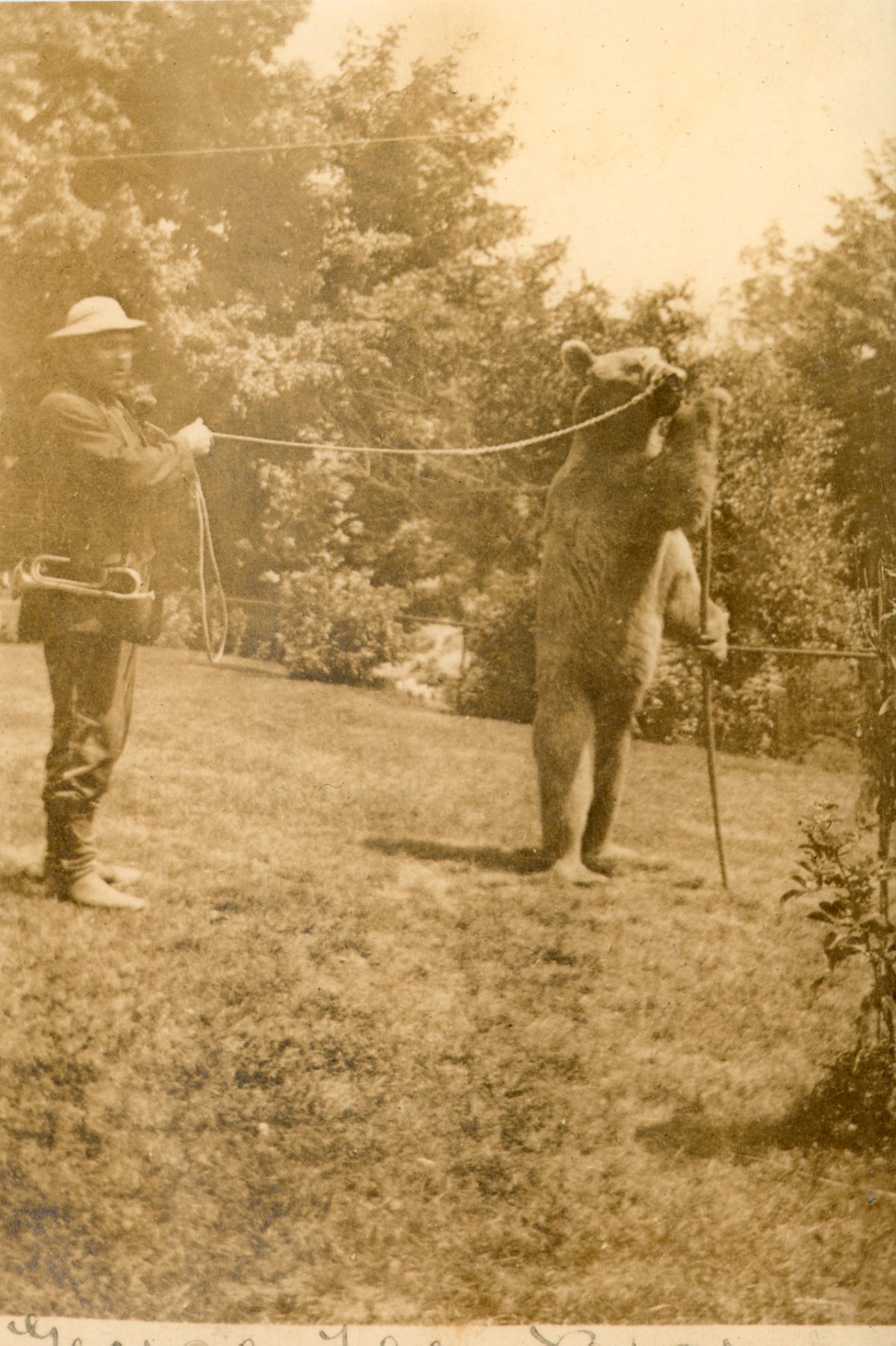
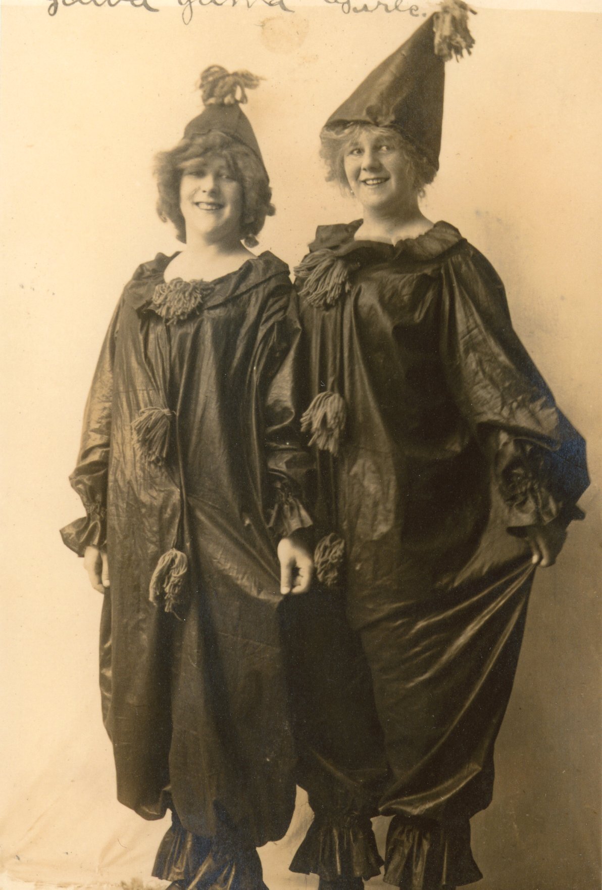
So much fun in Haines Falls! I am gratified to know that there were fun times for Irene Eliza Hallenbeck, after all. In the wooded fields, crevices of the falls and now, vanished hotels of Haines Falls, we know that among life’s struggles, fun did exist in the early 1900’s.
And now, as you drive through the mountain mist, you may hear faint echoes of hearty laughter and feel the warmth of comradery, the embrace of friendships and see friendly ghostly smiles of people and times gone by and be at peace knowing you are privileged to be having fun and getting a glimpse of heaven as you visit Haines Falls.

The Origin of Mountain Air
A glimpse of the machines that make snow happen at Hunter Mountain Ski Bowl.
The return of Winter to the valley of the Schoharie Kill is heralded by a great reawakening. Commencing in the early fall, as mountain roads fill with leaf-peepers and the nights begin dropping into the 40s, trucks can be seen winding their way up and down the side of the Colonel’s Chair at all hours as workmen prepare networks of hoses, pipes, and nozzles. In the base lodge management eagerly watches mercury drop in the thermometer. The residents of Hunter, heeding these signs of the approaching winter, commence their annual preparations for that long but never lonely season. Snowmaking has begun.
For over half a century a small team of specialists in the town of Hunter has spent five months of every year refuting the weathermen and their forecasts. The effort is heroic, the logistics dizzying, and the end goal particularly admirable: Fun. For all the sweat and stress of the process, the grand culmination of this effort is a smiling face at the end of a ski run - and this is what has made Hunter Mountain Ski Bowl a phenomenon of winter sports in the northeast.

I was treated to a walkthrough of the heart of Hunter’s snowmaking operations early in 2020 by someone deeply familiar with its intricacies. The majority of the equipment used to cover the Colonel’s Chair with snow is housed in a low metal building just uphill from the base lodge and somewhat hidden by trees. Having seen the system in action I will say it is hard to avoid drawing the conclusion that the snowmaking crew has summoned something more or less alive into being using some strange alchemy and a bunch of spare parts. It is entirely a one-of-a-kind composition.
Walking from room to room in the compressor building is a jarring experience for a first-timer: the ground pulses, the air hums with an electric charge, and immense mechanical contrivances whirl away behind protective railings like zoo creatures. There is no simple way to orient yourself in this outwardly unassuming building because the machines themselves governed the construction and size of their own enclosure. It all started off modestly sized, but as Hunter Mountain grew in scale more compressors were added - each receiving a custom concrete footing after which the building was expanded to encompass the new machinery in order to protect it from the elements it was partially responsible for creating. The end result is a structure that defies architectural convention while retaining something of the organic nature of the rocky mountain upon which it is built.

The inconspicuous sheds where the snowmaking process originates.
Snowmaking itself is a tightrope walk. By finding the right balance between water temperature, air temperature, pressure, and wind an experienced snowmaker can call down Nor’easters with remarkable regularity. Just getting it wrong with one of the variables can lead to mounds of slush, fleeting icy mists, or freezing rain which can coat a ski run (and the ski lifts) in a layer of ice. In the 61 years Hunter Mountain has operated they’ve pretty much turned this stunt into a science through careful experimentation and a few hard lessons, earning the apt moniker “Snowmaking Capital of the World.”

The critical ingredients in snowmaking have always been pressure and water. You need the water to make the snow, and you need the pressure to force the water through jets or nozzles into the correct size droplets that will freeze into snowflakes. The temperature of the water can be controlled to an extent, and the temperature of the ambient air determines when you can set the system in motion. While this is relatively simple to explain on paper, its practical execution is an entirely different beast. What follows are photos and descriptions of the components that make these ingredients for manmade snow, all part of a system developed by Hunter Mountain over several decades of experimentation.
Pressure, in the case of Hunter Mountain, is delivered by immense Ingersoll Rand Compressors powered by antique Westinghouse and General Electric Synchronous Motors. These units are monstrous, and the unstoppable immensity of one of these compressors in operation harkens to the days of stationary steam engines in factories. The units that pressurize the snow guns at Hunter Mountain almost all date to the interwar period of the 1920s, 30s, and 40s - Unit 7 was actually surplussed from a Navy Shipyard after World War Two (a story in itself), and all are still in fine working order due primarily to their robust construction and relative simplicity.
While the vintage of this equipment may seem remarkable, it is important to note that these machines were the replacement for Hunter’s original and quite crude snowmaking system. When Hunter first began producing manmade snow the only equipment available was being produced for agricultural irrigation. Low-pressure above-ground aluminum pipes, gasoline water pumps, and diesel air compressors made the process almost herculean. Coordinating workmen who had to activate pumps, water lines, and adjust the air/water mix at each snow gun meant the process required lots of manpower and training. Fuel needed to be fed to all the pumps constantly, and if one pump in the line failed or stalled the whole feed line needed to be drained and reset to prevent it all from freezing up.
This all goes without saying that temperature changes over the course of a day or night of snowmaking might require almost constant adjustment of each snow gun (or “Stick”) on the mountain. As the temperatures rose and fell different ratios of water and air from each stick needed to be adjusted manually to ensure the right composition of snow was falling from the nozzle. One miscalculation and each stick on the mountain could be spewing slush onto the trails. For this reason snowmakers at Hunter walked the ski trails as long as the guns were active, keeping an eye often all night long checking that everything was behaving as it was supposed to.
In the 1980s Hunter Mountain began to add computerization to a snowmaking system that had already grown beyond the old diesel compressors and water pumps. It is this system shown in the following photos, and one that even now is slowly being phased out as technological advances have yet again changed the way Hunter’s snowmakers call down the weather.
The above compressors ensure that there is about 70-80 pounds of air at each snow gun. With the compressors taking care of generating the pressure needed for snowmaking, the next part of the recipe is supplied by a small tributary of the Schoharie Creek that trickles its way down between the peaks of the Colonel’s Chair and Hunter Mountain proper.

Unprocessed bulk snow flowing down the side of the mountain. We often mistakenly call this fluid “water.”
This small stream, the Schoharie Creek itself, Dolan’s Lake, and a separate purpose built reservoir supply a season’s worth of water for snowmaking, but it isn’t as simple as sucking the water into a pipe and blasting it out at the top of the ski trail. Since Hunter’s snowmaking system slowly became automated in the 1980s the water collected for snowmaking has had to go through an additional process prior to being sent up the mountain to make sure that it is at an optimal temperature. Think of it as passing the fluid through a radiator to chill it down to the point where it is ready to freeze. That is where this device called the Cooling Tower comes in:


Once water is chilled to the correct temperature it is piped through a manifold into a wing of the compressor building where pumps send the water uphill. A total of roughly 21 electric pumps rated at between 400-600 horsepower each are required to move water from the reservoirs, to the cooling tower, and then to the trails themselves. The main pumphouse, located under the same roof as the compressors, houses eleven such water pumps alone, and each services pipes to specific trails depending on the day’s requirements:


Just as water pumped up the mountain needs to be temperature regulated, so does the compressed air generated in those compressors we showed you earlier. The “reconditioning” process for compressed air requires equally complex systems. When air is compressed it warms - and warm air is quite literally at the top of the checklist of “things that make snow melt.” You can imagine therefore why cooling that compressed air back down might be important.

One of the outgoing air lines from Compressor 9. On several other compressors in the building these “Hot” lines are worn to a polish from years of chilled snowmakers sitting on them after a shift moving snow guns on cold winter nights. The author vouches they are quite comfortable to sit on.
What follows are some images of the room where compressed air is chilled. Because Hunter was one of the earliest snowmaking operations in the Northeast much of the system now in use is entirely custom because there was literally nobody making the components they needed. Nowhere is that “custom solutions” ethos more visible than here:


Cooled air and water finally make their way up the mountain through a myriad of pipes and hoses until they are combined in individual snow guns. The original sticks that were used to coat the mountain, which were upwards of thirty feet high, required all the air pressure the compressors developed at this point, and that 70-80 PSI pushed the water up the final stretch to the nozzle. If the snowmaker made their adjustments correctly the desired droplets formed manmade snow. Continuing refinement of techniques and equipment as relegated the “stick” to the museum - replaced by far more efficient stationary guns and smaller portable nozzles like the ones below to fill in gaps in coverage.

These newer, more efficient portable guns are a sign of the times illustrating the continuing advancements made by snowmakers in their annual effort to cover Hunter with snow.
The snowmaking operation at Hunter, in its perpetual process of refinement and advancement, will not look like this for too much longer. Smaller, more efficient compressors, advanced computer controls, and better coverage from powerful stationary snow guns have already sounded the death knell for the remarkable creation whose heart resides in the compressor building. It probably won’t be too many years before technological advancements relegate much of what you’ve seen here to the history books.

The control station, featuring tools which come in handy during long night shifts watching the monitors.
By Jonathan Palmer, Assistant Greene County Historian
Questions and comments can be directed to archivist@gchistory.org

Our Plantations
Slavery, murder, and contemplating the crimes of our forefathers.
“… the Petitioner and his ancestors and those under whom they named have
ever since the year of our lord one thousand six hundred and sixty eight been
in the quiet possession of a farm and plantation situate on the west side
of Hudson’s River in the County of Albany and on the north side of a
creek called the Catts Kill…”
— From the confirmation of lands to Teunis Van Vechten
by the Governor of the Colony of New York, 1770
The legacy of slavery touches us all, despite whatever you may have heard. It is easy for us Northerners to imagine the peculiar institution as something distant; a crime framed as something “they” did which “we got rid of.” Such thinking gives us the moral high ground and corroborates what we want to believe about our heritage. This thinking, which I hear all the time, is cloaked behind the same insidious half-truths that brought us such classics as:
“The Civil War was fought over State’s Rights”
~or~
“My family didn’t own slaves”
We here in upstate New York live wrapped in the comfortable but completely unfounded belief that our closets aren’t jam-packed with the same yucky history as those of our southern countrymen. We tell ourselves a whole bunch of things: “the plantation system didn’t exist here,” that “by the time slavery was abolished in New York it was already almost totally gone,” and perhaps the grandest of lies in that vein, that “Slavery here in the Hudson Valley wasn’t as bad as other places.”
For a time I believed that last one, and I’ve since spoken it aloud a few times just to remind myself that I can be a real idiot sometimes. I suppose believing such a thing possibly helped me sleep at night, because it turns out my ancestors owned a ton of slaves. They owned slaves who worked and died where I went to High School, where I grew up, and even where I go for walks to clear my head. Their ghosts are everywhere, and their graves are unmarked so I can never make a pilgrimage to their hallowed ground.
Before I continue I should make one thing abundantly clear - I am no expert on slavery in the Colony and State of New York. I’m an archivist, and I occasionally put on a historian’s hat because I find stories that I have the hubris to think I can tell. When it comes to slavery in the Hudson Valley the only thing I have any qualification to speak on are its trappings - the remnants and ephemera of a complex system of exploitation that persisted even beyond the time when slavery was ended in New York. Such items, once mundane in function, are now priceless reminders of a time that was not nearly as long ago as you and I would like to think.
So what are these “trappings?” Take for an example a scrap of paper I found the other week in the Rebecca Doherty Memorial Collection. It was a receipt stuffed in a file with a selection of other receipts and notes of Jacob Van Hoesen. For Jacob these papers once held the same value as the receipt you might save for a new television or your last trip to McDonalds - some of them were worth hanging onto for a year, some not so much, and for whatever reason all these pieces of paper were accidentally kept in a box for 250 years. I love it when that happens.
So, among receipts for such things as shoe buckles and assorted goods was a scrap noting Jacob’s final payment made in 1788 to Albertus Van Loon for “that wench which he bought of me [A. Van Loon].” It was written below an accounting of other debts Albertus and Jacob must have haggled over that month. Albertus didn’t even need to write the woman’s name down, nor her age, because he had his money and she was now Jacob Van Hoesen’s property. Jacob could call her what he liked.
Bills of sale of enslaved persons are often only a little more descriptive than that. The usual format of these documents is a paragraph of legalistic “party of the first part and party of the second part” type jargon establishing who is giving who money. A sentence then often follows which gives the name and age of the person being sold, and then more legalese closes with signatures and pretty wax seals. They look like this:

Bill of Sale of Piet, a ten year old boy, from Mattys Halenbeck to Johannes Brandow, 1769.
The minimal ceremony involved produces a document that, except for the name, reads kind of like the bills of sale they used back in the day for things like sloops. In the eyes of the law the only difference between the slave and the sloop was that the latter was worth more and required other forms of registration. These bills of sale represent a fundamental refutation of the origin and value of personhood, and they fly in the face of a century of enlightenment philosophy which our nation so proudly founded itself on the principles of.
Such documents as the scores of bills of sale preserved in our archives testify to the mundane cruelty of Slavery. Virtually all of us heard in history class the horrible stories of black children being sold out of the arms of their mothers at southern slave auctions - what we didn’t hear (and what these receipts testify to) is that more or less the same scene happened right here in Coxsackie, not two miles from where I learned about these crimes perpetrated in the South before the Civil War.
On the few occasions I’ve had the pleasure to discuss American slavery this is usually the point where we hit the “you can’t judge the past by modern standards” part of the conversation. Some people get really tripped up by this and I don’t know why, because even by the standards of post-revolutionary America the conclusion was pretty widespread that slavery was not only morally corrupt, but a refutation of the democratic ideal we purportedly embodied as a culture. This means to say that what my great-great-great-great-great grandfather did was wrong, and his neighbors knew it, and two centuries later I know it too.
Abolition movements existed virtually from the inception of the nation, and the founding fathers (whether they chose to speak on it or not) knew Slavery was the question they weren’t brave enough to address as a government in the 1780s and ‘90s. John Adams and Thomas Jefferson, one a staunch abolitionist and the other a slaveowner, would live long enough to see the Union almost shattered in the debates preceding the Missouri Compromise of 1820 - a very obvious result of their inability to resolve the slavery debate during the creation of the Constitution, Bill of Rights, and their respective presidencies. Indeed it would be less than forty years after their deaths that the nation was nearly destroyed in the name of slavery, and the mending that occurred immediately following the Civil War was so incomplete that we are still reeling from the complications over 150 years later.
At the beginning of this essay I included an excerpt from the Confirmation Grant of the Van Vechtens for their lands in Catskill. I was compelled by the use of the phrase “Plantation” in the language of the document. The term “Plantation” has evolved over several centuries, but at that time (1770) the word was already closely tied to an understanding of colonial power dynamics and cash-crop agricultural enterprises. This is probably why the phrase reads “Farm and Plantation” in the grant instead of using just one word or the other - i.e. they were operating as both. A great explanation of the word “plantation” is available through this link.

Samuel Van Vechten, Farmer
— from a slide of a portrait done c. 1710
Suffice to say, by common definitions of the word the Van Vechtens were operating a plantation on their land. In an entirely self-sustaining universe along Catskill Creek they cultivated a variety of crops, milled their own grain and processed their own lumber as well as that of their neighbors, and produced a surplus that afforded them an exceedingly comfortable living - especially for a family on the frontier. Samuel Van Vechten was not running about in his coat and silk neckcloth in 1710 doing all of this by himself, nor were his nephew and great nephew who later inherited the land. In fact (you guessed it) the majority of the work that delivered the family its pre-revolutionary wealth was probably completed using enslaved Africans and some indentured servants (two VERY different things if you ever hear someone compare the two).
The only record we have of the enslaved people who worked the Van Vechten “plantation and farm” during the pre-revolutionary period is anecdotal - slaves who lived and died at Van Vechten’s were buried in a grove carefully described in Beers’ History of Greene County in 1884 - meaning that even if no record exists of their purchase or sale there were old-timers who still recalled the place where these people were interred. This same spot was partially destroyed in the 1920s, and a news clipping noted that several skeletons were uncovered by accident.
Except for the Van Vechten House itself, there is no trace of the plantation where these people lived out their lives as property. Such is not the case two towns north in Coxsackie. There, on the grounds of the Bronck House, stands a monument which you can still touch and stand in to connect with the lives of the slaves who worked that farm. The Bronck/Bronk family, much like the Van Vechtens and every other well-to-do Dutch family in what is now Greene County, owned several slaves at a time - operating a farm of a scale so considerable and profitable that it is laughable to think Judge Leonard Bronk ever walked behind a plow on his own land. He, occupied as he was with matters of local governance and law, almost exclusively ran his farm as a manager - leaving labor to the people he bought and sold in the years after the Revolution.
As a working farm the epicenter of all labors was the barn. Here was where the harvest was processed, hay was laid in store, and tools were kept from the weather. It was the place where any enslaved person would have begun and ended their workday, and the place they would have frequented the most in their routines around the farm. Built around 1790, the Dutch Barn is not only the oldest outbuilding on the Bronck Museum campus, its also the only building that can be interpreted exclusively in the context of the slaves who worked from it, around it, and likely even assisted with its construction. I’m personally of the opinion that it is the only building left in Greene County that can be understood solely in this context, and that makes it exceedingly important as a site of consciousness - a place that stares back at us as we examine it, giving testament to a story we may not want nor be ready to hear.

The c. 1790 Dutch Barn at Bronck House, Coxsackie.
I’m writing this on June 1, 2020, watching the news of cities burning and riots in the streets following the murder of a black man named George Floyd. I’ve heard all sorts of things about the validity of the protests, supporting the police, the looting and rioting “totally discrediting” the message of the protest movement itself. I’m sad that such things are the first words to come from the mouths of people I know, and I’m sad that it takes riots in Washington DC to precipitate a national debate on the heinous behavior of some members of law enforcement agencies. I have no solution to the cultural issues that continue to plague our country, but I do know that George Floyd’s murder is exactly the same at its core as Albertus Van Loon’s sale of a wench to Jacob Van Hoesen. She was never named, her personhood was denied her, and her right of self-determination stripped away because she was an African-American slave. She was less than human, and she was denied the right to exist as one. George Floyd was an American who was deemed guilty until proven innocent, his voice was ignored, and his killer felt perfectly justified in his actions because in this country we have a lingering, cancerous notion that sometimes it is ok to behave that way towards a black man - “he probably did it.”
There are some who even now question the necessity of nationwide protests over the killing of George Floyd, and it troubles me to hear this for a multitude of reasons. A riot and its violence can’t be condoned, but are we prepared to value George Floyd less than the window panes that got broken and the cars that got burned? Is the slave still worth less than the sloop in 2020? Accepting that there is little difference between these two moments is a big step, and you don’t need to get there right away, but you can do something else in the meantime - head down to the barn, think about it, and acknowledge what happened.
“I can’t breathe”
Questions and comments can be directed to Jonathan Palmer, Assistant Greene County Historian, via email at archivist@gchistory.org
Recalling Darker Days
Reflections on the Cholera of 1832 and lessons we can learn from that historic pandemic.
In August of 1832 a foul and reeking sloop sat anchored off the shore at Athens filled with the dead and dying. A rowboat bearing litters plied between it and the shore, echoing Charon on the Styx as it continually returned empty of passengers. On shore, smoke billowed into the sky from burning buckets of tar as a lone horse and cart slowly made their way through the streets spreading lime in open gutters. The scene was apocalyptic, and all was at a standstill. Clergy and doctors had fled to the mountains out of base fear, and many of those who remained were soon laid low by the unseen foe. The wealthy and poor alike were not spared, and the greatest minds of the age were at a loss as to a recourse for the plague that had beset the region.
News from the Recorder on 16 August 1832.
The Cholera was a terrifying unknown, and across the County distinct Boards of Health all attempted as best they could to treat a disease they didn’t know the cause of. Extant receipts of the Boards of Health of Athens and Catskill testify to the dire nature of the situation and the town-wide mobilization that occurred in an attempt to stop the spread. At Athens James Foster’s sloop was rented as a temporary hospital at the onset of the epidemic in mid-August. His vessel was a well-used freight boat which had been laid up as river-borne commerce slowed drastically amid the fear that gripped the Valley from Albany to New York. The sloop, a poorly ventilated cargo vessel, was ill-suited to the role of a hospital. Between the sun beating upon its deck and the foul conditions prevalent in the hold it is a wonder any thought the vessel a suitable option for the care of Cholera victims. Mr. Foster netted the equivalent of three hundred dollars for its temporary use, also supplying material for litters as well as a wagon and workman for burying two victims.
A selection of other bills submitted to the Athens board of Health is as follows:
Nathan Clark hired out workmen from his Pottery on Market Street for part of a morning to dig a ditch as a sanitary measure.
Amos Durham, the cemetery sexton, was paid thirty eight dollars for the burial of the dead between August seventh and September twelfth.
Castle Seeley, the Village postmaster, submitted a bill for twenty eight dollars as compensation for several sizable orders of lime. He also sought reimbursement for money he personally paid Doctor Williams to attend the sick that August.
James Brown was paid three dollars total for his efforts crossing the river on several nights after the ferry stopped running to summon doctors from Hudson to attend patients at Athens.

Bill of Amos H. Durham, Cemetery Sexton, for services rendered the Athens Board of Health in August and September 1832.
~
Things were no better in Catskill by the end of August. Dr. Thomas O’Hara Croswell had been appointed the role of Health Officer by the newly formed Village Board of Health. He assumed that duty in addition to his responsibilities as postmaster, druggist, and physician, knowing there was probably no other person better suited to the task. He had been attending to the medical needs of Catskill’s citizens for practically forty years (his practice predated the County and Village governments by almost a decade) and he had seen much in that time. Recollections of the 1803 Yellow Fever probably tempered his natural optimism, reminding him of the not-infrequent futility of a doctor’s ministrations on the gravely afflicted.

Resolutions of the Board of Health of the Village of Catskill, 12 July 1832 edition of the Recorder.

Message to readers from Dr. Croswell in the 12 July 1832 edition of the Recorder.
Through July and into August he added statements in the Board of Health’s published reports, noting on several occasions “the village is unusually healthy at this time.” Readers of the Recorder probably found great comfort in his assurances, which were printed on the page opposite regional news where tabulations of the death toll at New York were updated weekly. In late August Catskill started getting cases, and notifications from the Board of Health, together with Dr. Croswell’s assuring words, ceased appearing altogether as the Health Officer became entirely consumed in his duties to the sick.
A lengthy bill tabulates the supplies requested in outfitting a temporary hospital which the Catskill Board of Health constructed for their Cholera victims. The shipping and warehouse firm of McKinstry and Day supplied everything from bread and milk to candles, matches, fabric for bedding, and even tar ostensibly for burning between August twenty-first and September nineteenth, finally receiving payment in November of that year. Likewise Solomon Woodruff put his wagon to use, carrying and spreading lime across the village for two months from July through August on credit, additionally carrying supplies to the Hospital when required.
It was all for naught, and most who contracted the Cholera that year succumbed to it. The village and town Boards of Health conducted all of their labors under the misguided supposition that the Cholera spread through “miasma” - odiferous and noxious fumes originating from the prevalent unsanitary conditions in their community. Inadvertently they ended up attempting to address some of the problems that indeed contribute to Cholera’s spread, but they never addressed fully the issues of groundwater and food that had been contaminated unknowingly by human feces. It would be another decade before fecal contamination of drinking water was known to be a cause of Cholera, and another fifty years before even the Village of Catskill had a municipal water system to offer its citizens safe drinking water.
All of this was naturally called to mind at the sight of the Hospital Ship USNS Comfort arriving this week in New York Harbor. How far a cry it is from the sloop anchored at Athens in 1832, and how far a cry from that epidemic are we as well. It is difficult for us even in the grips of this great crisis to fully understand the breadth and scale of the fear that our forebears endured at the onset of the Cholera, though we certainly have had a taste of it which the imagination runs with. The Cholera alighted itself on shores of the United States at a time when no scientific foundation existed to understand its root cause. Even the symptoms eluded the medicines of that age. It was not understood why or how the Cholera arrived, nor how its victims were selected, and diagnosis in that time was more often followed by death rather than treatment. It is a great triumph of our time that we know the disease we are fighting against, and the ammunition at our disposal to prevent its spread (however simple it may seem) has never been given a better opportunity than now to be effectively wielded. Further reading on the Cholera of 1832 is linked below.

USNS Comfort arriving in New York Harbor. US Navy via Getty Images.
Click here to read County Historian Ray Beecher’s article on the 1832 Cholera.
Click here to read Karla Flegel’s history of the 1832 Cholera in the Hudson Valley.
Click here to read about the Second Cholera Epidemic 1826-1837.
Click here to watch an interview with Dr. Fauci on the Daily Show concerning Covid-19.
By Jonathan Palmer, Assistant Greene County Historian